


![Request for Information – Potential [Placeholder for Prize]](https://assets.science.nasa.gov/dynamicimage/assets/science/missions/a-step/FFR_Earth_Background_20251120%20.png?w=1024)


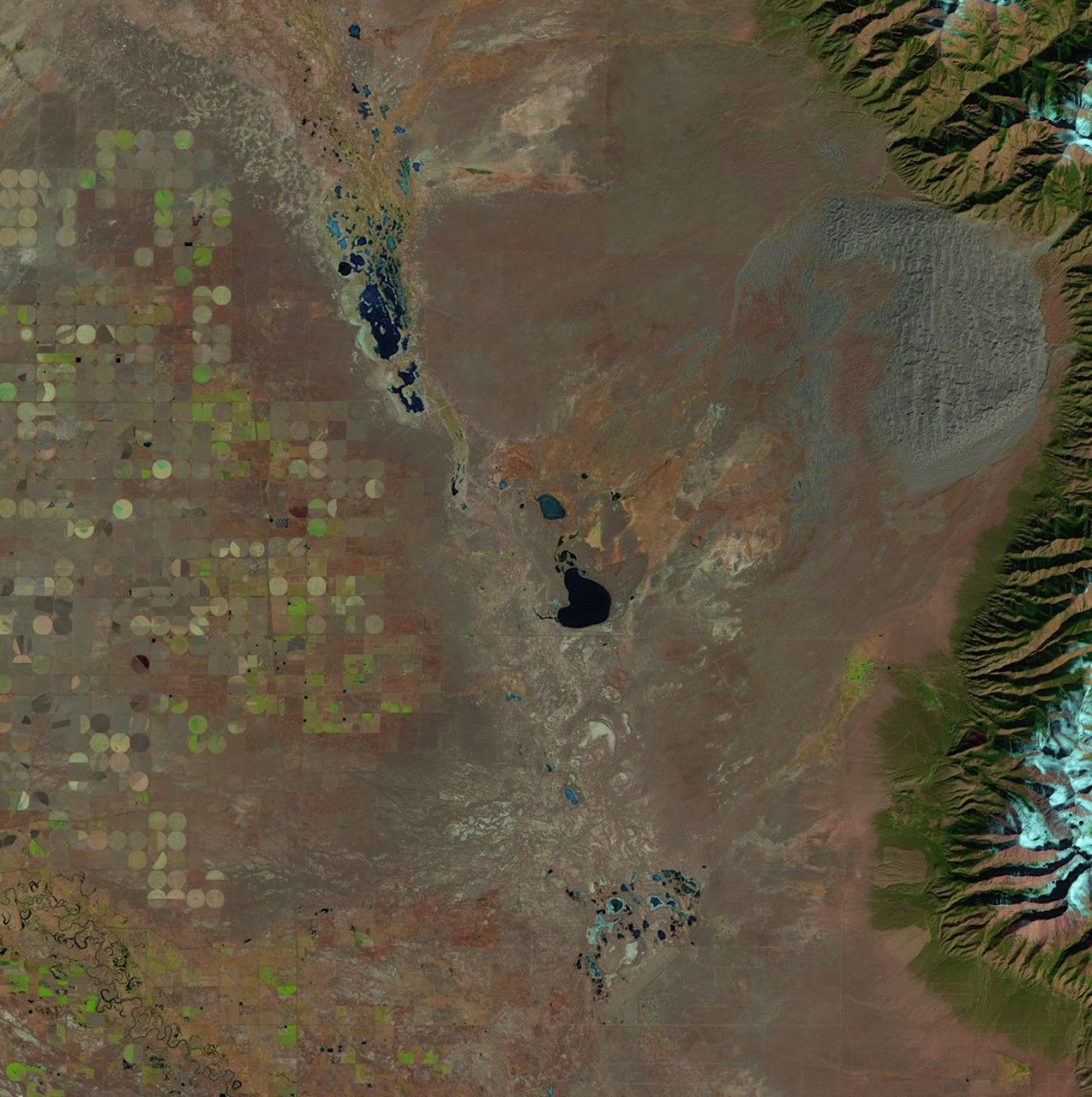
before
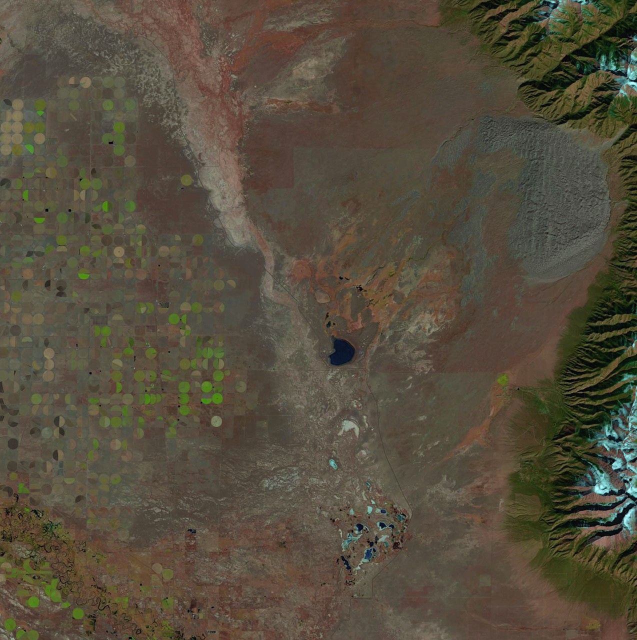
after


Before and After
San Luis Valley stream change, Colorado
October 21, 1987 - October 23, 2011
The Great Sand Dunes National Park and Preserve, home of the tallest sand dunes in North America, is the newest U.S. national park. It is located in the San Luis Valley at the base of the Sangre de Cristo Range in Colorado. The valley’s stream flows change from season to season and year to year, and these images show the difference between 1987 and 2011. Water access is especially critical in the region as center pivot irrigation systems (shown as circular features west of the feeder streams) rely on aquifer recharges. Originally a national monument, the area was given the distinction of national park in September 2004. Images taken by the Thematic Mapper sensor onboard Landsat 5. Source: U.S. Geological Survey (USGS) Landsat Missions Gallery "The Great Sand Dunes National Park," U.S. Department of the Interior / USGS and NASA.


