


![Request for Information – Potential [Placeholder for Prize]](https://assets.science.nasa.gov/dynamicimage/assets/science/psd/solar/2023/09/s/solarsystem_0.jpg?w=1024)


Earth Stories
Filters

The color of Adélie penguin droppings reveals what the birds are eating, offering scientists a way to track how sea ice conditions influence their diet.

Utah’s new solar power and battery storage facility is among the largest in the region.

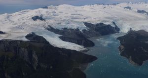
Snow-capped mountains carved by deep river valleys preside over northwestern Washington state.

Brown carbon, emitted by wildland fires and tracked over the span of a week in July 2026, worsened air quality in parts of the U.S. and Canada.

As of July 20, the public can access data from the two powerful radar instruments aboard the NISAR (NASA-ISRO Synthetic Aperture Radar) satellite. Teams in the United States and India will release files processed from the satellite’s L-band and S-band…
Differences in the underlying bedrock and how rivers distribute sediment make the coastlines west of Portland look unlike those northeast of the city.
The first of six new airborne campaigns will hit the skies this summer.

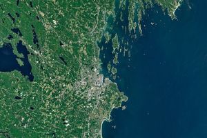
The hills and basins of Seattle, Washington, have been sculpted by glaciers and modified by humans.
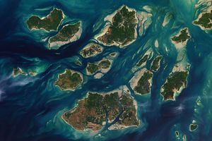
The expansive mudflats, sandy beaches, and mangrove forests of the Bijagós archipelago support an array of migratory shorebirds and large numbers of sea turtles.

Canadian wildfires sent plumes of smoke streaming over Ontario, Quebec, and parts of the U.S. Midwest and Northeast.