


![Request for Information – Potential [Placeholder for Prize]](https://assets.science.nasa.gov/dynamicimage/assets/science/psd/solar/2023/09/s/solarsystem_0.jpg?w=1024)


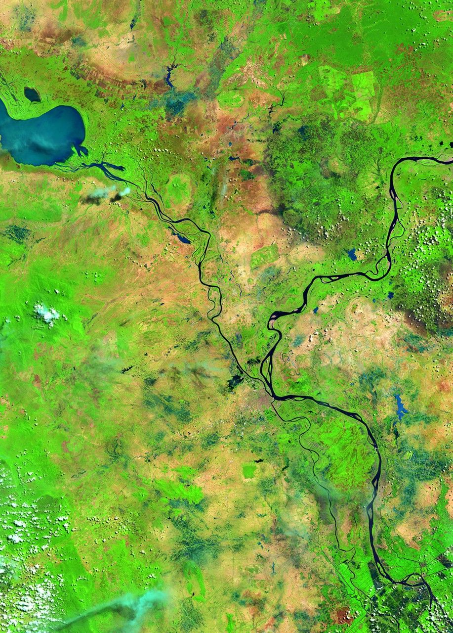
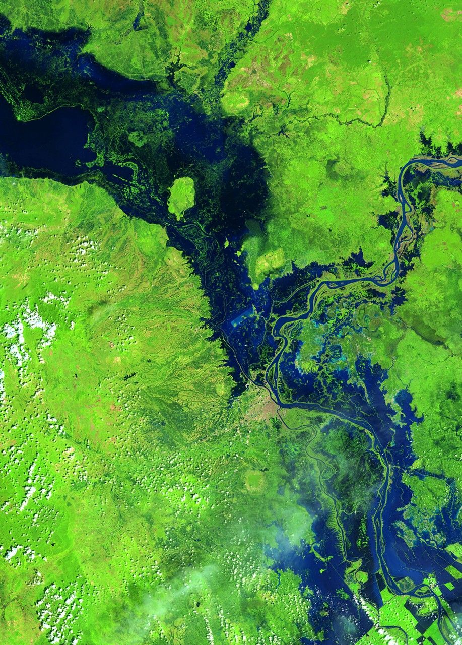
before
after


Before and After
Typhoon Nari flood, Cambodia
May 17, 2013 - October 24, 2013
In October 2013, Typhoon Nari followed heavy seasonal rains to create substantial flooding along the Mekong and Tonlé Sap Rivers in Cambodia. The flood affected more than a half million people, and more than 300,000 hectares (about three-quarters of a million acres) of rice fields are believed to have been destroyed. The capital city of Phnom Penh is just south of the image center. Images taken by the Operational Land Imager onboard Landsat 8. Source: U.S. Geological Survey (USGS) Landsat Missions Gallery "Flooding in Cambodia," U.S. Department of the Interior / USGS and NASA.


