




























APOD
Astronomy Picture of the Day
Discover the cosmos! Each day a different image or photograph of our fascinating universe is featured, along with a brief explanation written by a professional astronomer.
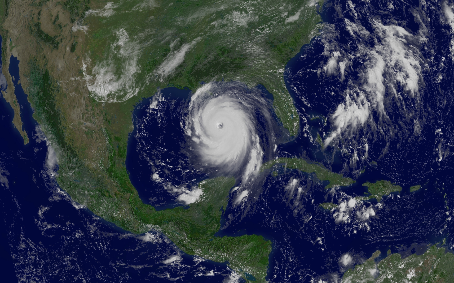
Hurricane Katrina in the Gulf of Mexico
Explanation: Where will Hurricane Katrina go? One of the stronger storm systems of modern times appears headed for landfall somewhere in the southern USA sometime today. Katrina was designated yesterday a rare Category 5 Hurricane , the strongest designation for a storm on Earth, and one that indicates sustained winds greater than 250 kilometers per hour. Pictured above is a digitally processed image from the orbiting GOES-12 weather satellite that shows the massive storm system yesterday in the Gulf of Mexico . Starting as a slight pressure difference, hurricanes grow into large spiraling storm systems of low pressure, complete with high winds and driving rain. A hurricane is powered by evaporating ocean water, and so typically gains strength over warm water and loses strength over land. Much remains unknown about hurricanes and cyclones , including how they are formed and the exact path they will take.
| Date | August 29, 2005 |
|---|---|
| Credit | Credit: GOES 12 Satellite, NASA , NOAA |
| Authors & editors: | Robert Nemiroff (MTU) & Jerry Bonnell (UMCP) |
| A service of: |
ASD at NASA / GSFC, NASA Science Activation & Michigan Tech. U. |