![Request for Information – Potential [Placeholder for Prize]](https://assets.science.nasa.gov/dynamicimage/assets/science/missions/a-step/FFR_Earth_Background_20251120%20.png?w=1024)


wr3-grid
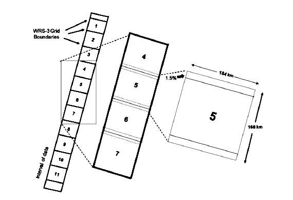
Diagram showing satellite imagery grid systems with WRS (Worldwide Reference System) grid boundaries. On the left is a vertical strip of 11 numbered scenes, and to the right is a wider strip with scenes 4-7 visible. A detailed view shows a single scene (#5) with dimensions of 185 km width and 184 km height, with a 7.5% overlap between adjacent scenes.
Image Credit: NASA
- X
https://science.nasa.gov/image-detail/amf-34e6bb32-9514-4c22-843b-e6ec5c4fd4e0/
Image CreditNASA
Size570x389px