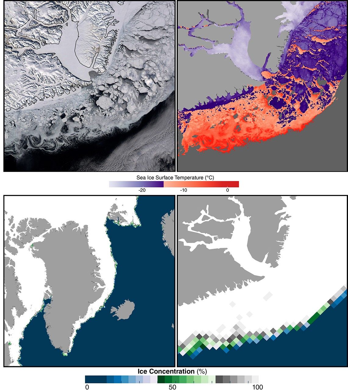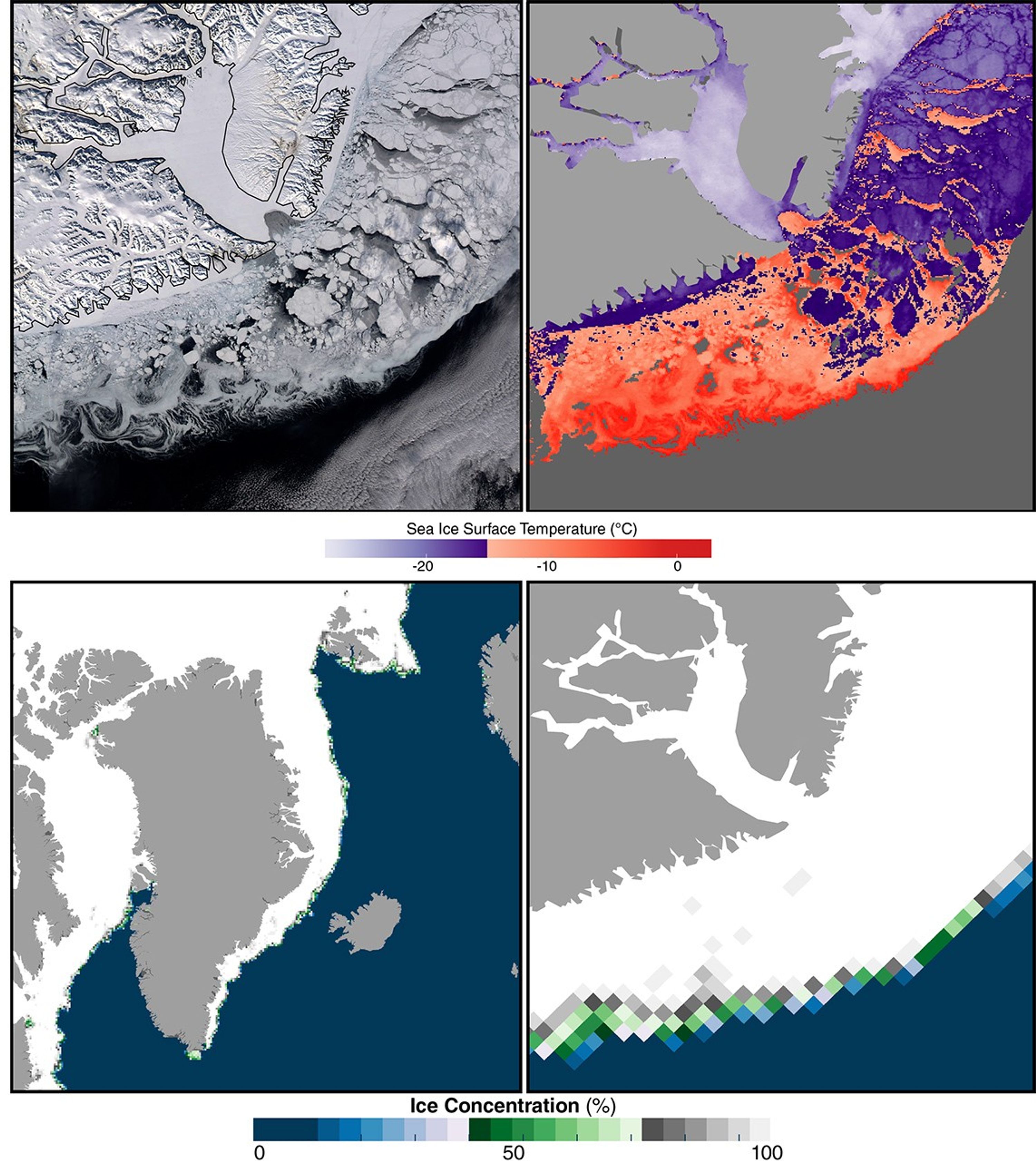
East Greenland Sea Ice as seen by MODIS and AMSR-E
These images of East Greenland on March 27, 2010 are from Aqua. A MODIS image (upper left) shows glaciers and snow cover on land, and sea ice floes in the ocean. Ice-surface temperature (IST) derived from MODIS (upper right) increases roughly with decreasing sea ice concentration from AMSR-E (lower right) toward the ice-water boundary.
Image Credit: NASA
- X
https://science.nasa.gov/image-detail/amf-5eabf4a8-6c26-4d5b-9f9e-f911a5837ff7/
Image CreditNASA
Size3000x3360px