


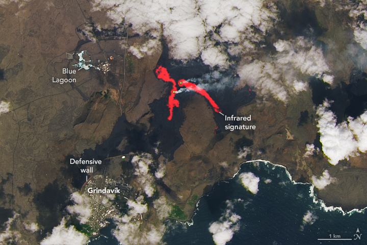
Iceland Eruption Goes Another Round
A volcanic fissure on the Reykjanes peninsula came alive again with voluminous, vigorous flows. View the full story
Image Credit: NASA Earth Observatory / Lauren Dauphin
- X
https://science.nasa.gov/image-detail/icelanderuption-oli-20240602/
TakenJune 2, 2024
Image CreditNASA Earth Observatory / Lauren Dauphin
Size720x480px