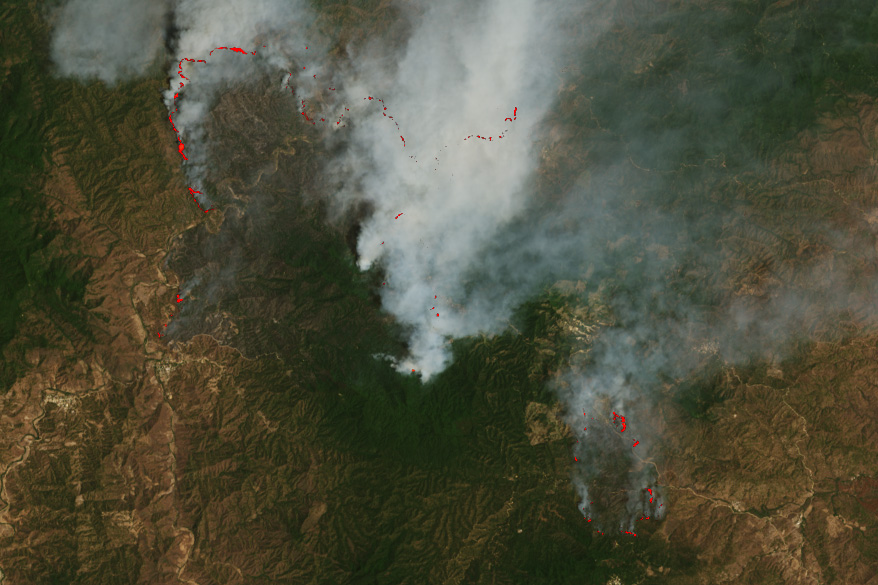
This image shows smoke billowing from one such fire near the border of neighboring states Oaxaca (west) and Chiapas (east) in southern Mexico. The OLI-2 (Operational Land Imager-2) on Landsat 9 acquired the image at about 10:30 a.m. local time (16:30 Universal Time) on March 27, 2024. The image is natural color (bands 4-3-2) overlaid with pixels from a false-color image to emphasize hot spots associated with the fire front.

Fire in Southern Mexico

More than 100 active fires burned across the country in late-March 2024, including this blaze near the border of Oaxaca and Chiapas. View the full story

Credits: NASA Earth Observatory / Wanmei Liang