


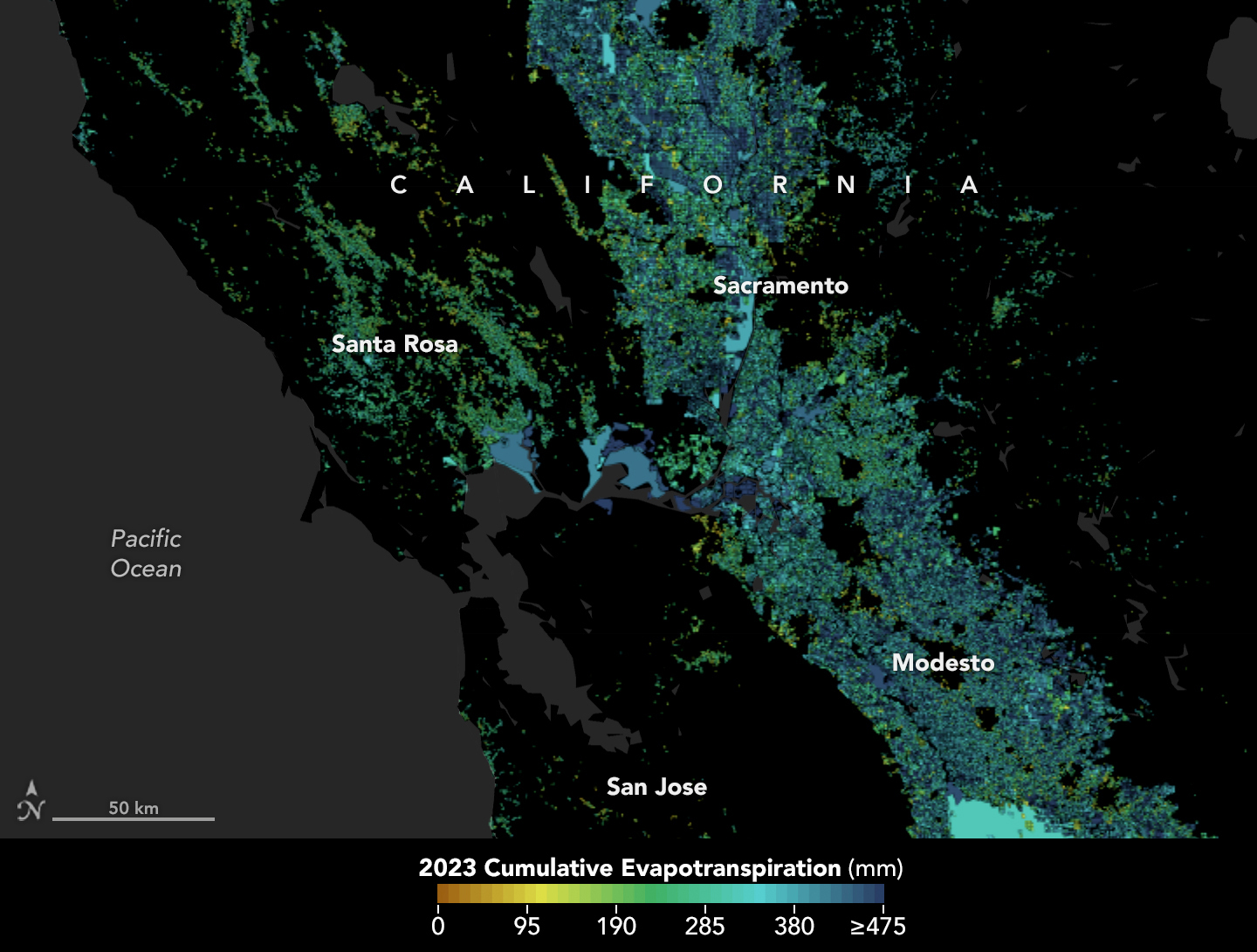
Tracking the Invisible Movement of Water
A moisture measurement tool known as OpenET is improving the way farmers, ranchers, and water resource managers steward one of Earth’s most precious resources. View the full story
Image Credit: NASA Earth Observatory using openetdata.org
- X
https://science.nasa.gov/image-detail/openetwideca-model-2023/
Image CreditNASA Earth Observatory using openetdata.org
Size1024x775px