


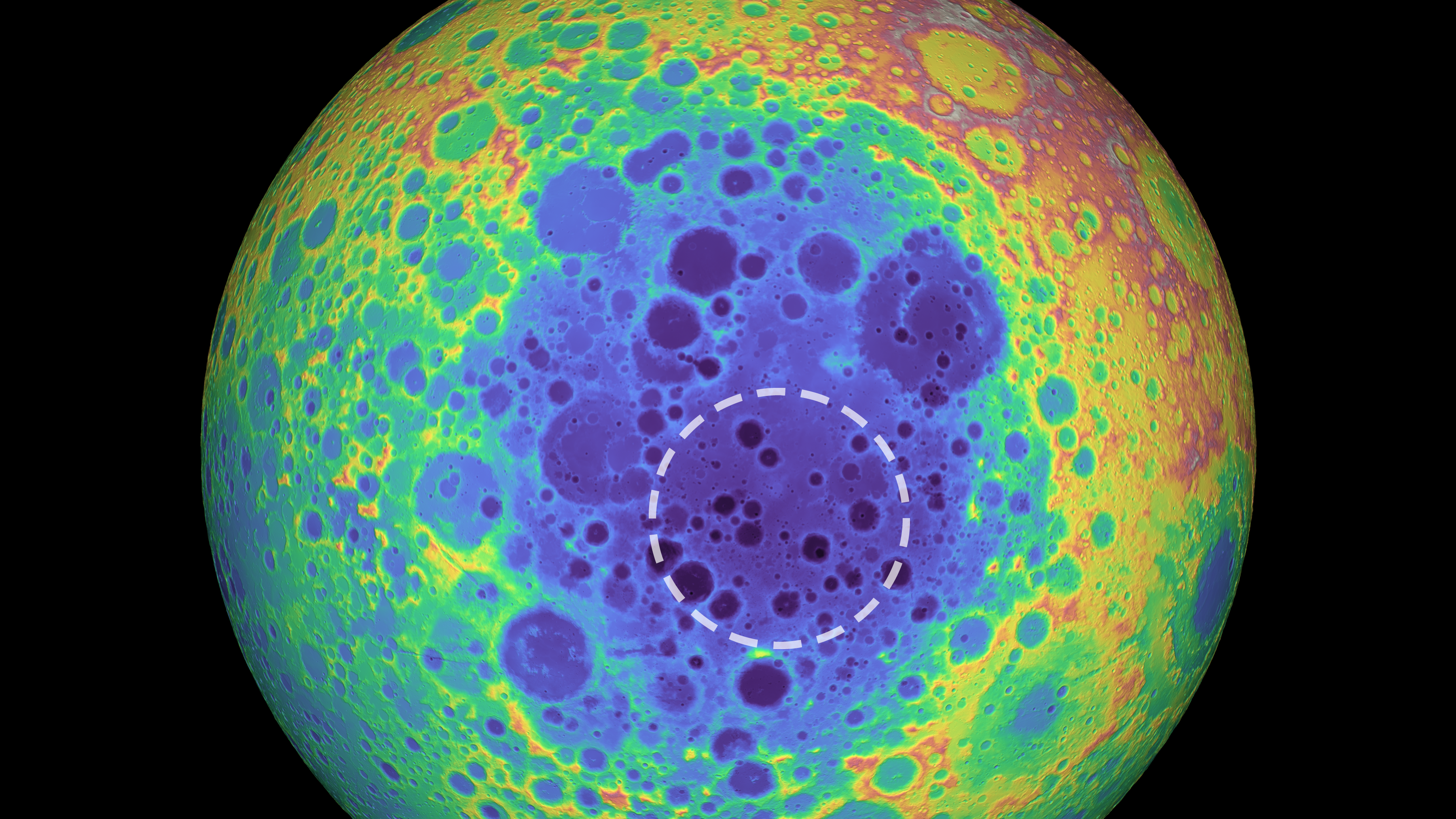
south-pole-aitken-basin-annotated
A dotted line shows the location of the dense mass in the South Pole-Aitken Basin. In this topographical map, blue indicates low elevations and red indicates the highest elevations.
Image Credit: Image: NASA/GSFC/University of Arizona; Annotations: P James (Baylor University)
- X
https://science.nasa.gov/image-detail/south-pole-aitken-basin-annotated/
Image CreditImage: NASA/GSFC/University of Arizona; Annotations: P James (Baylor University)
Size1024x576px