


IceBridge
Operation Ice Bridge
Type
Airborne Campaigns
Target
Objective
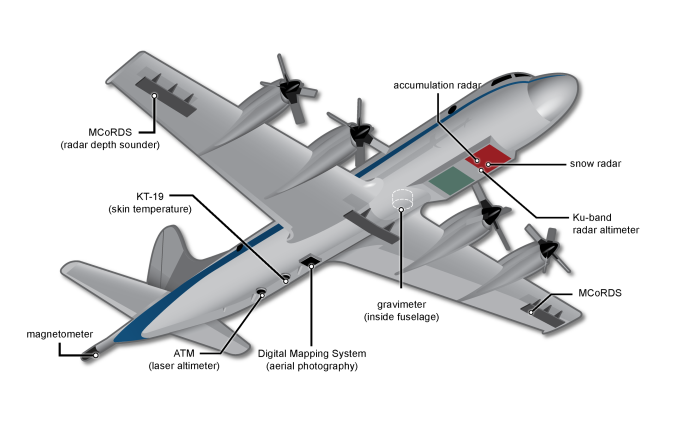
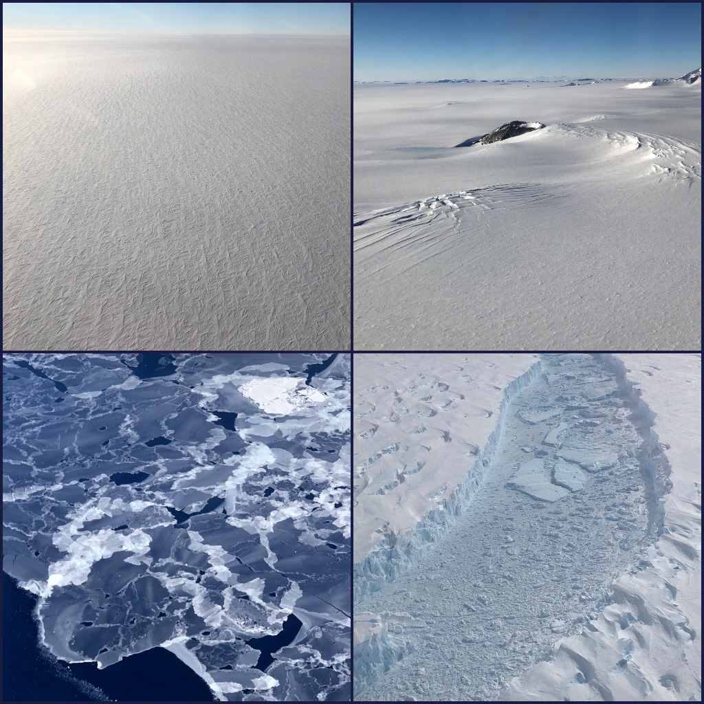
NASA’s Operation IceBridge images Earth’s polar ice in unprecedented detail to better understand processes that connect the polar regions with the global climate system. IceBridge utilizes a highly specialized fleet of research aircraft and the most sophisticated suite of innovative science instruments ever assembled to characterize annual changes in thickness of sea ice, glaciers, and ice sheets. In addition, IceBridge collects critical data used to predict the response of earth’s polar ice to climate and resulting sea-level rise. IceBridge also helps bridge the gap in polar observations between NASA’s ICESat satellite missions.
Program Objectives
- Make airborne altimetry measurements over the ice sheets and sea ice to extend and improve the record of observations begun by ICESat.
- Link the measurements made by historical airborne laser altimeters, ICESat, ICESat-2, and CryoSat-2 to allow accurate inter-comparison and production of a long-term, ice altimetry record.
- Monitor key, rapidly changing areas of ice in the Arctic and Antarctic to maintain a long term observation record.
- Provide key observational data to improve our understanding of ice dynamics, and better constrain predictive models of sea level rise and sea ice cover conditions.
Science Goals
- Document volume changes over the aircraft-accessible portions of the Greenland and Antarctic ice sheets during the period between the ICESat and ICESat-2 missions. A particular focus will be to document rapid changes.
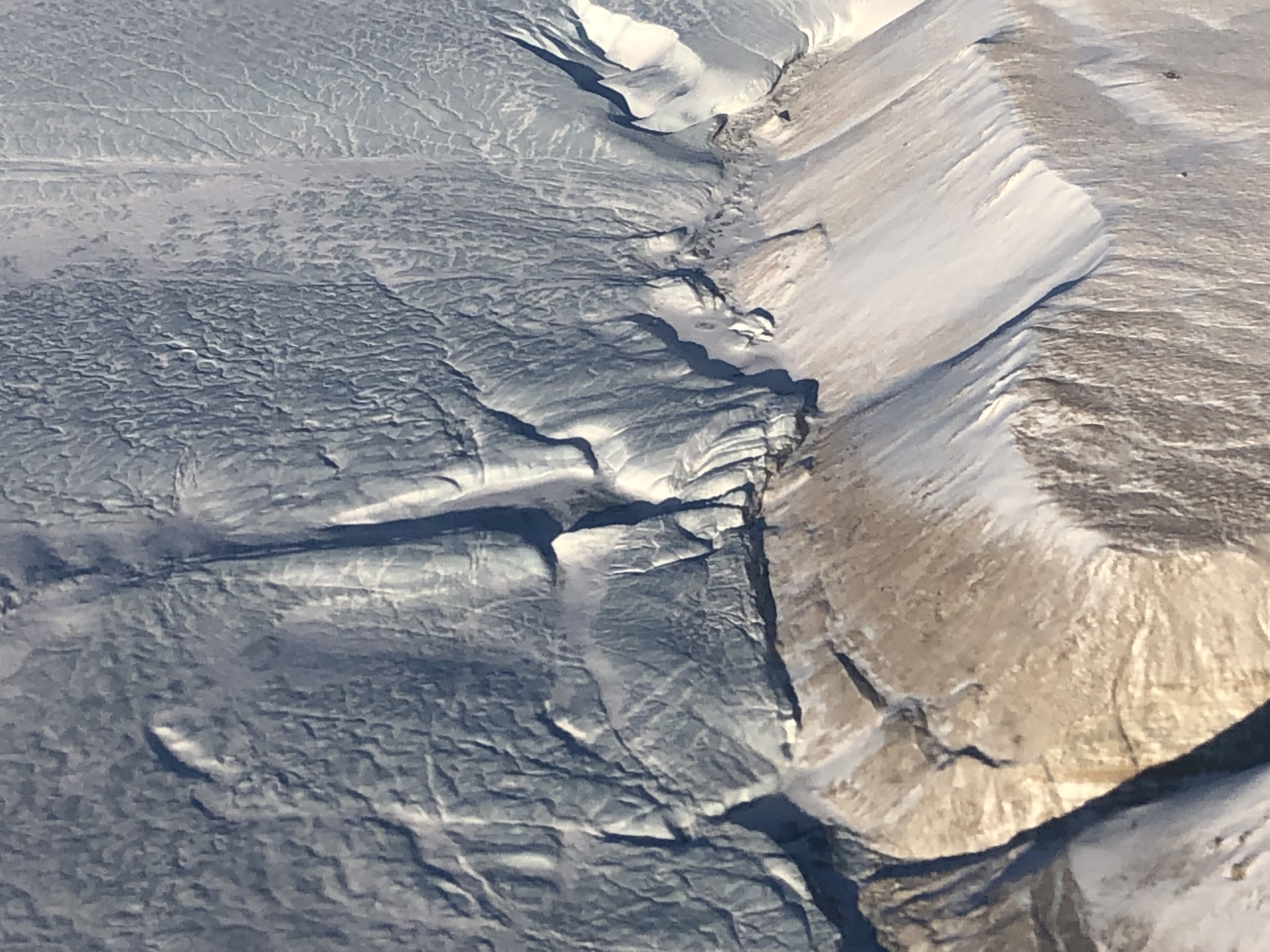
- Document glacier and ice-shelf thickness, ice-shelf bathymetry, snow accumulation-rate variability and other geophysical properties to better interpret volume changes measured with laser altimetry and to enable more realistic simulations of ice-sheet flow and mass balance with numerical models.
- Document spatial and interannual changes in the mean sea ice thickness in the Arctic and Southern Oceans in the period between ICESat and ICESat-2, in support of climatological analyses and assessments.
- Improve sea ice thickness retrieval algorithms by advancing technologies for measuring sea ice surface elevation, freeboard and snow depth over sea ice in the Arctic and Southern Oceans.
NASA's Operation IceBridge Completes 11 Years of Polar Surveys
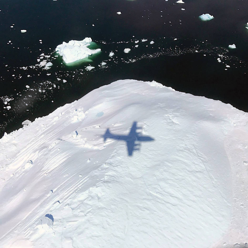
For 11 years from 2009 to 2019, the planes of NASA’s Operation IceBridge flew above the Arctic, Antarctic and Alaska, gathering data on the height, depth, thickness, flow and change of sea ice, glaciers and ice sheets.
IceBridge Stories and Images

NASA’s Operation IceBridge images Earth’s polar ice in unprecedented detail to better understand processes that connect the polar regions with the…
Everything on our planet — the land, the water, the air, people — is connected by the various chemical, physical…

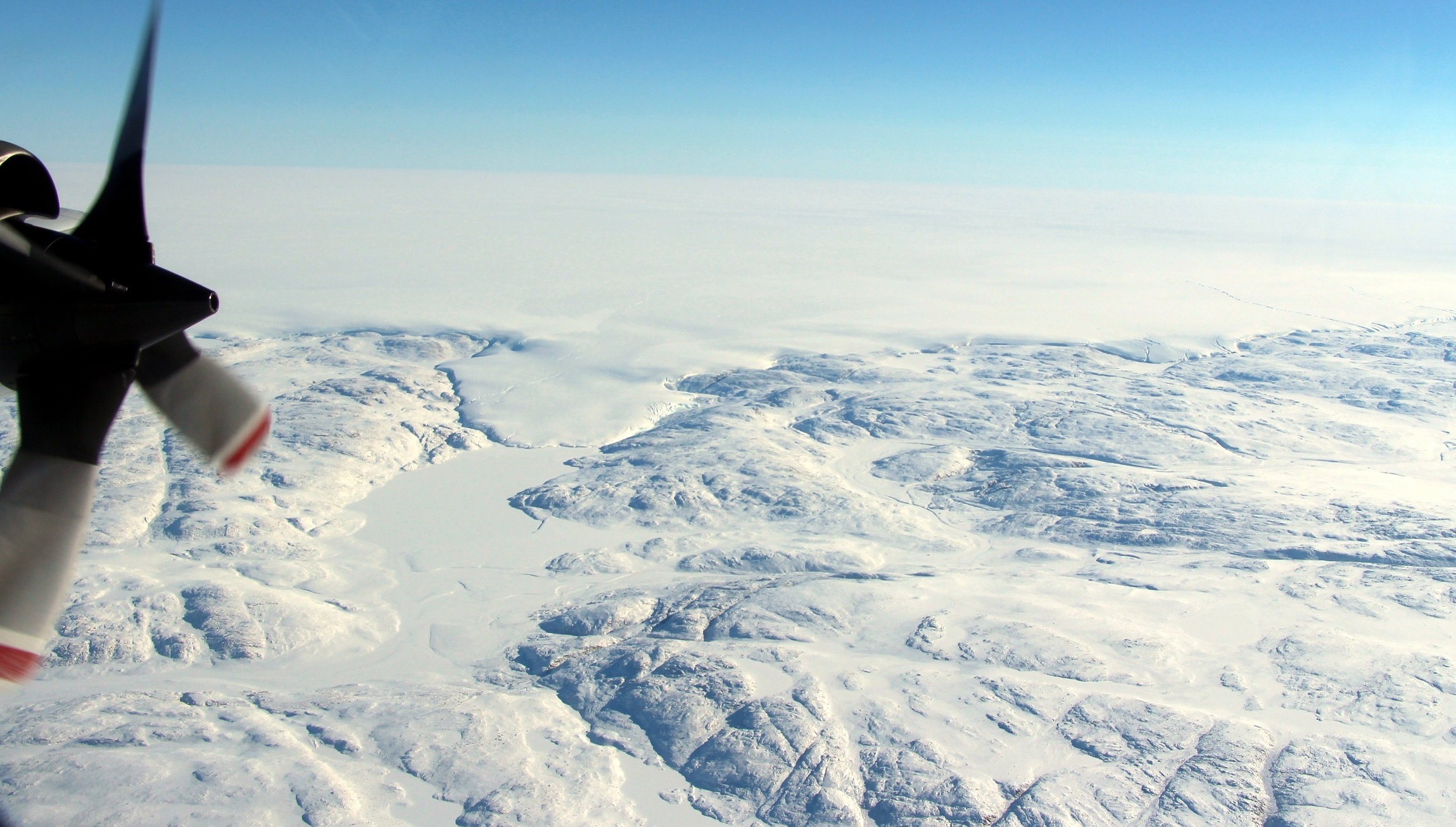
by Emily Fischer Flying a plane over Alaska's vast landscape provides a birds-eye view of some incredible sights. Bears run…
For eleven years from 2009 through 2019, the planes of NASA’s Operation IceBridge flew above the Arctic, Antarctic and Alaska,…
by Kate Ramsayer Operation IceBridge took off on the first flight of its final polar campaign Thursday, with a route…
The skies were clear, the winds were low, and the lasers aligned. In April, instruments aboard NASA’s Operation IceBridge airborne…
This is the last year for Operation IceBridge, NASA’s most comprehensive airborne survey of ice change. Since the launch of…
A NASA glaciologist has discovered a possible second impact crater buried under more than a mile of ice in northwest…

Less than three months into its mission, NASA’s Ice, Cloud and land Elevation Satellite-2, or ICESat-2, is already exceeding scientists’…
An international team of scientists came together to unravel the mystery of Greenland’s Hiawatha crater. This video shows how that…
by Kate Ramsayer / ANTARCTICA / I knew they were my favorite as soon as I saw them. Sastrugi, the…
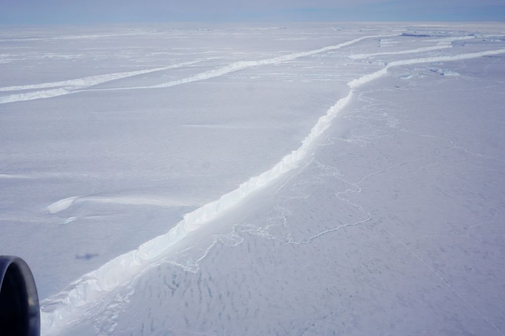
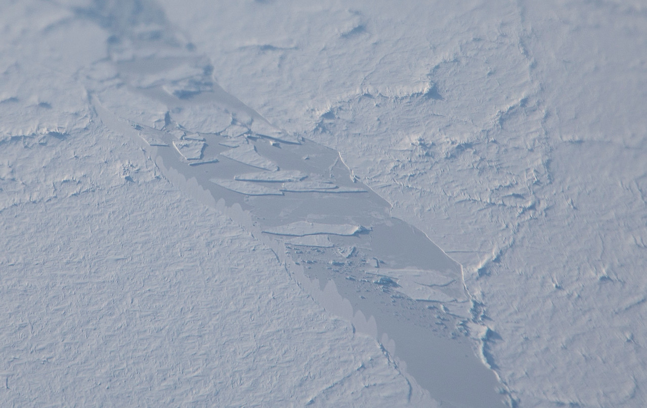
by Kate Ramsayer / THE SKIES ABOVE ANTARCTICA / The crack that would become B-46 was first noticed in September…


