


Oceans Melting Greenland
NASA’s Oceans Melting Greenland (OMG) mission completed six years of oceanographic measurements revealing the ocean plays a strong role in Greenland’s ice loss.
Type
Launch
Target
Objective
NASA Greenland Mission Completes Six Years of Mapping Unknown Terrain
To learn how ocean water is melting glaciers, NASA’s Oceans Melting Greenland mission extensively surveyed the coastline of the world’s…
Read the Story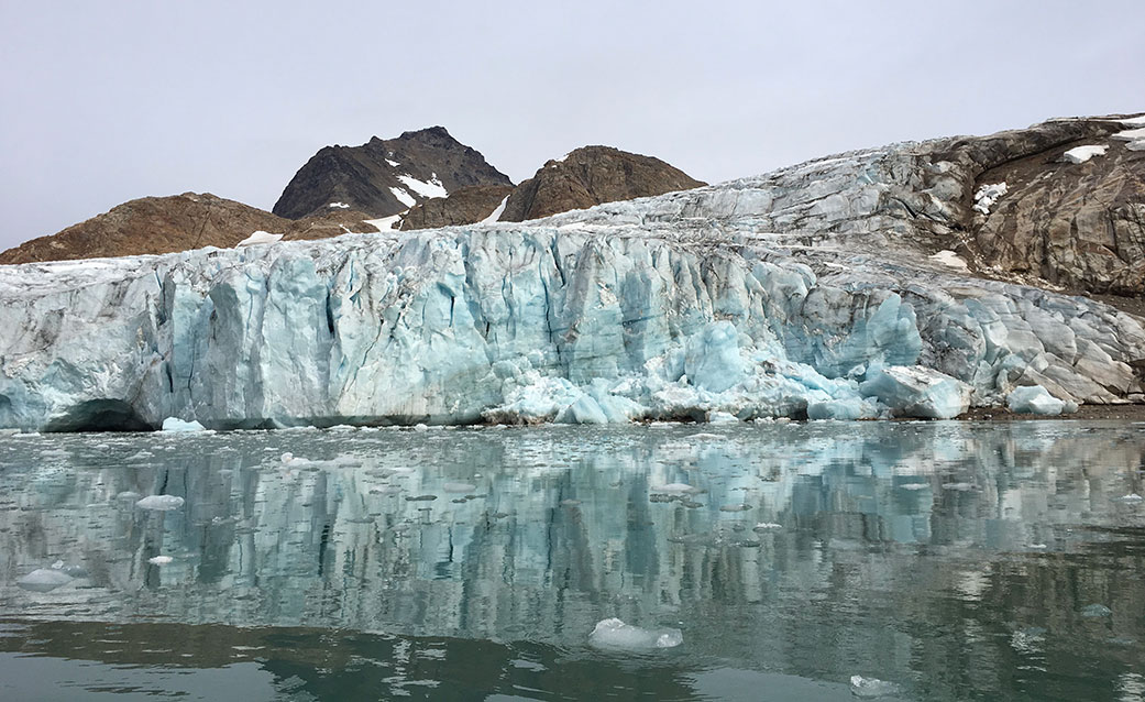
NASA's OMG: Where the Water Meets the Ice
Join JPL scientist Josh Willis in this video as he and the NASA Oceans Melting Greenland (OMG) team work to understand the role that ocean water plays in melting Greenland’s glaciers. From the sky and the sea, NASA’s OMG mission gathers data on glaciers and water temperature all around Greenland as they try to get a better picture of global sea level rise.
Watch
Global sea level rise will be one of the major environmental challenges of the 21st Century. Oceans Melting Greenland (OMG) has paved the way for improved estimates of sea level rise by investigating the question: To what extent are the oceans melting Greenland’s ice from below? Over a six-year campaign, OMG measured changing water temperatures on the continental shelf surrounding Greenland, and how marine glaciers reacted to the presence of warm, salty Atlantic Water. OMG also facilitated improved measurements of the shape and depth of the sea floor because its complicated geometry steers currents and determines whether Atlantic Water can reach into the long narrow fjords to interact with the coastal glaciers.
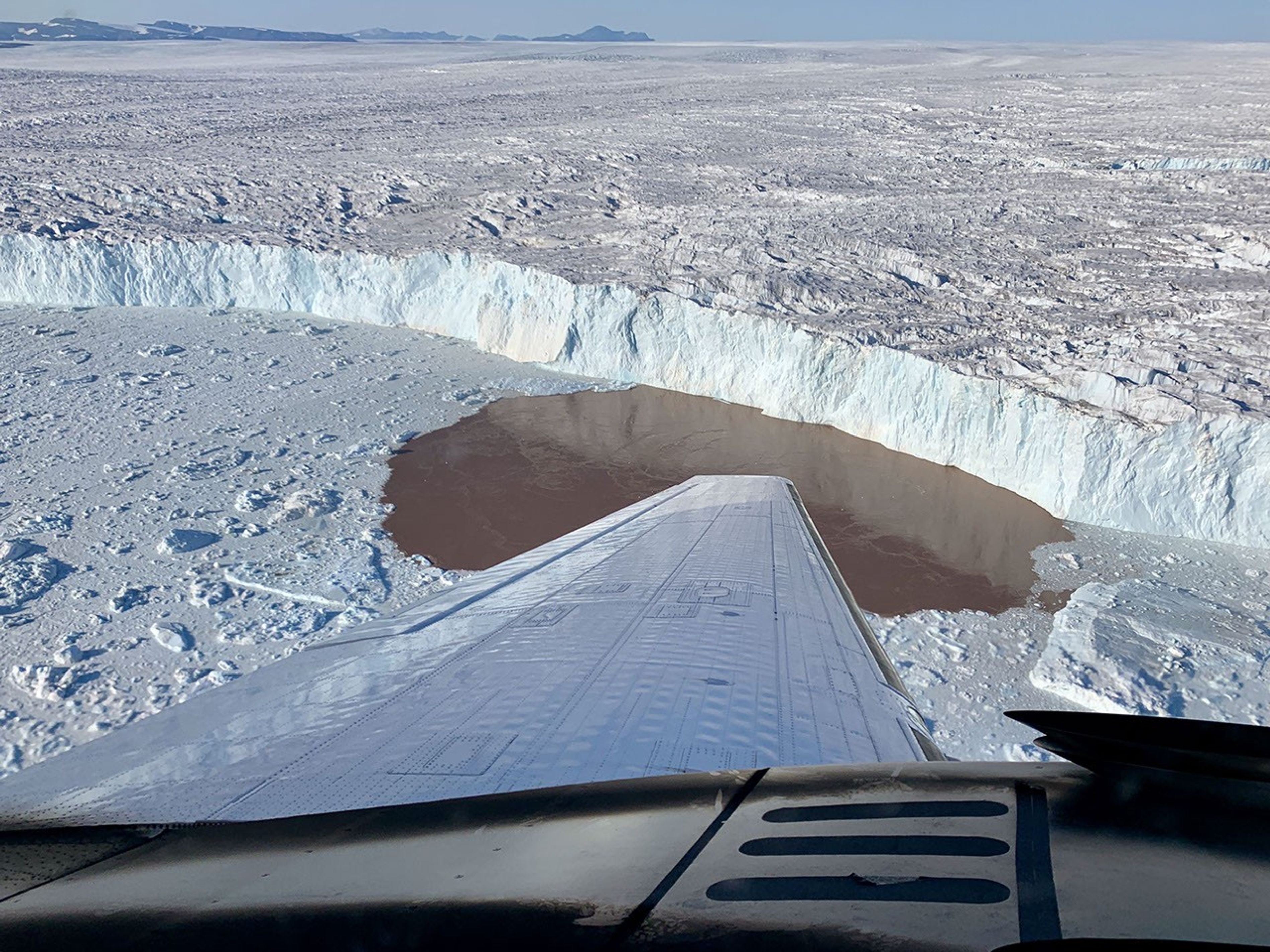
To measure changes in the deep layer of warm water around Greenland, OMG conducted an aircraft campaign each year in the summer to deploy 250 expendable temperature and salinity probes along the continental shelf. These measurements were matched with corresponding observations of the ice: OMG used NASA’s G-III to fly the Glacier and Ice Surface Topography Interferometer (GLISTIN-A) in order to generate high resolution, high precision elevation measurements of Greenland’s coastal glaciers during the spring. These annual surveys by GLISTIN-A were used to quantify the thinning and retreat of ice over each season. These data, along with fundamental new observations of the sea floor geometry, provided a revolutionary data set which is being used to understand Greenland’s ice loss, model ocean/ice interactions, and improve estimates of global sea level rise.
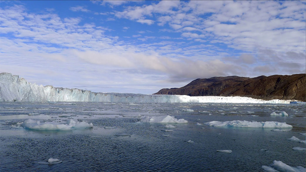
Understanding Glaciers
A typical Greenland glacier reaches the water in a long fjord or canyon, where a layer of cold, fresh surface water sits above a deeper layer of warm, salty water. The video explains how the meltwater runs off at the bottom of the glacier and causes a plume which erodes the edge of the glacier. Temperature of the deep warm water layer is a key factor in how rapidly the plume will melt away the ice.
Watch