


About OMG
-
Why is NASA in Greenland?
Greenland’s melting ice affects the whole world. Greenland’s ice sheet contains enough water to raise sea levels by 7.4 meters (25 feet) worldwide.
Greenland, shown here on the globe, is located northeast of Canada. It is the world’s largest island and home to the second largest ice sheet in the world.

-
Why is the climate warming?
Humans are changing the climate by burning fossil fuels for energy. These add greenhouse gases to the atmosphere, which trap extra heat from the sun and warm the air and oceans.
But the oceans get most of the extra heat. In fact, more than 90% of the heat trapped by greenhouse gases warms the oceans, not the air.
Warmer air is melting Greenland’s ice. But so are warmer oceans. NASA’s Oceans Melting Greenland (OMG) mission is trying to figure out how much of Greenland’s ice melt is caused by warming oceans.


The Mission
OMG started its 5-year mission in 2016. Each year, OMG did two surveys, all the way around Greenland:
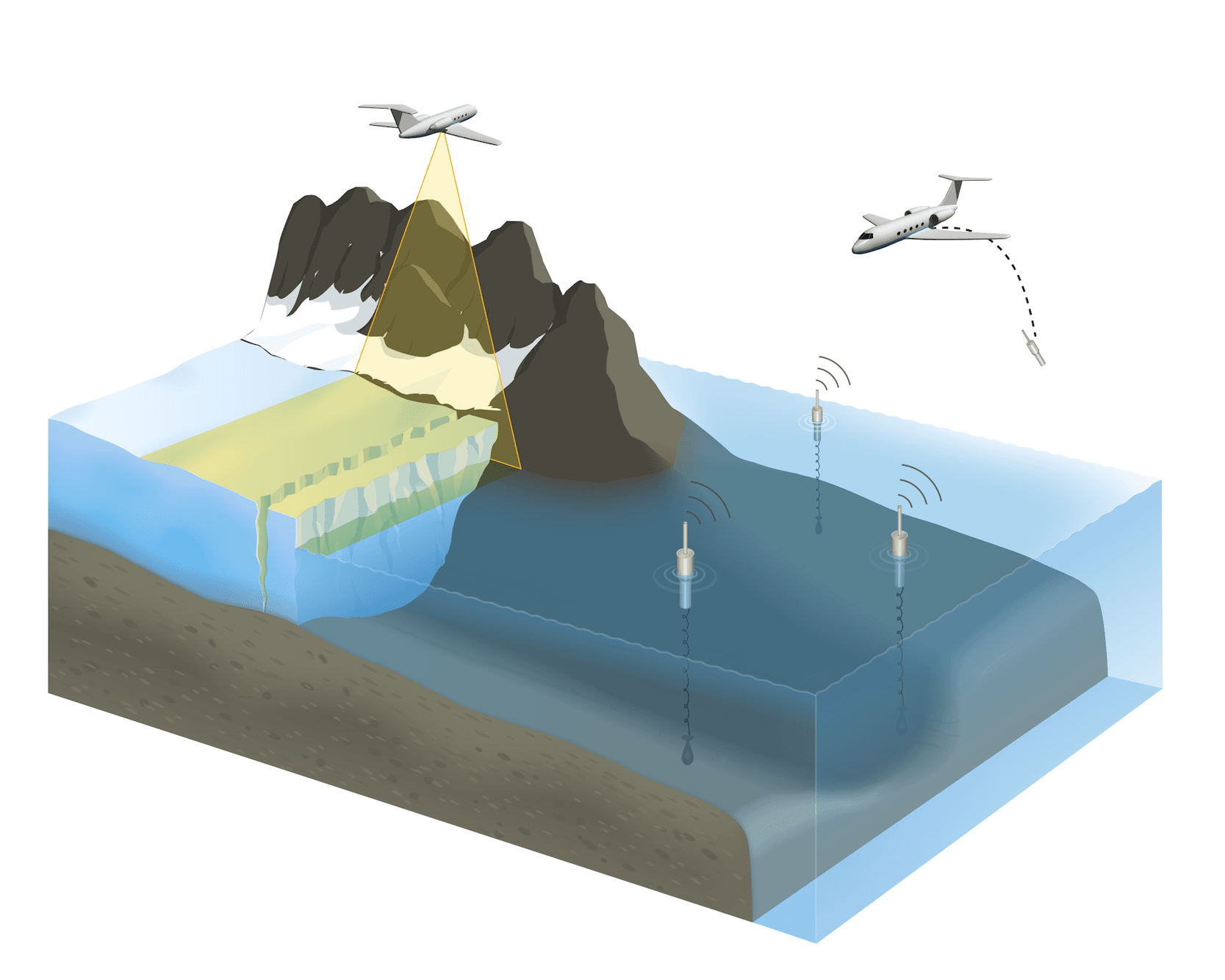
1. An ocean survey (summer) where probes are dropped from an airplane to measure the temperature and saltiness of the water.
2. An ice survey (spring) where an airborne radar looks at how the ice is changing from one year to the next.
In the illustration, on the left, the GLISTIN-A radar scans the ice. On the right, AXCTD probes are dropped into the ocean.

Ocean Survey (Summer)
In summer, there is less sea ice. With more open water, this is the best time to drop ocean probes next to the Greenland coast. Each year, OMG drops about 250 ocean probes to measure the temperature and saltiness of the water around Greenland.
To drop a probe, the aircraft flies low (between 500–5000 feet) in order to make sure that no people, equipment, or wildlife are near the drop zone. Do the probes bother ocean animals? No, the probes don’t emit any sounds and operators always make sure the water is clear before dropping them.

- Probe is dropped from the plane, parachute opens
- Probe lands in the water
- Buoy floats to the surface and transmits data back to the plane, while probe sinks
- After 15 minutes, both buoy and probe sink to the ocean floor and eventually decompose

Ice Survey (Spring)
Spring is the best time to fly the radar over Greenland. It’s just before the snow melts, and the dry snow gives a better return for the radar.
So every spring, the Glacier and Ice Surface Topography Interferometer (GLISTIN-A) radar—also known as UAVSAR’s Ka-band radar—is deployed to Greenland on NASA’s G-III plane. It flies 80 lines over Greenland’s more than 200 glaciers.
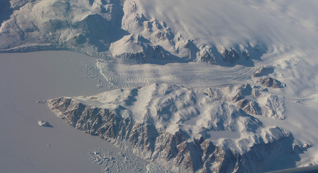
The radar measures glacier heights and also finds the edges of the glaciers. This allows OMG scientists to see how the thickness of the glaciers is changing over the years.


GLISTIN-A radar data over Greenland.
Watch OMG on Deployment
Josh Willis, OMG’s principal investigator (PI), takes you along for the mission and drops some ocean probes.
Watch

