.png?w=1024)


T-98: Radar Looks for Changes
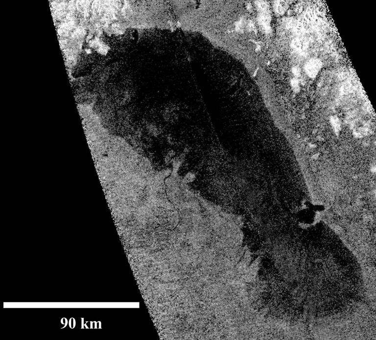
During this close flyby of Titan, the Cassini Radar looked for changes to the shoreline of Ontario Lacus when compared to the T-57/58 (June/July 2009) and T-65 (January 2010) fly-bys. The instrument was used as a synthetic aperture radar, a technique which uses that spacecraft's flight path to simulate a very large radar aperture.
On both approach and departure, the Composite Infrared Spectrometer (CIRS) mapped Titan's stratospheric temperatures to monitor seasonal change. The Imaging Science Subsystem (ISS) rode along with CIRS to track clouds. On approach, the Visible and Infrared Mapping Spectrometer (VIMS) rode along to map the lakes and seas of the North Pole; on departure, VIMS rode along to observe the evolution of the south polar vortex.
Titan Flyby at a Glance
Date
Feb. 2, 2014
Altitude
786 miles (1,236 km)
Speed
13,000 mph (5.9 km/sec)