September 2025
NASA Science Calendar Image of the Month. Image credit: NASA’s Gulfstream V Research Aircraft

Explore with us
September 2025 Image
Learn about September amazing image. Explore related topics, activities, games, and download desktop wallpaper.
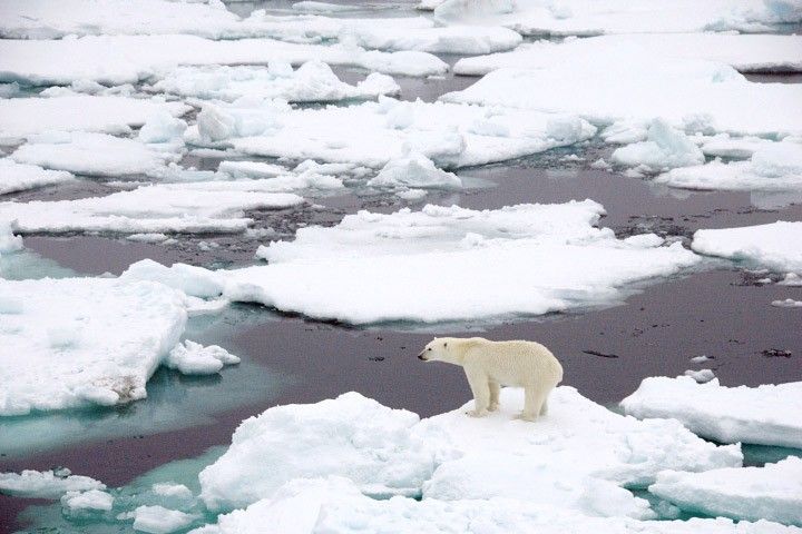
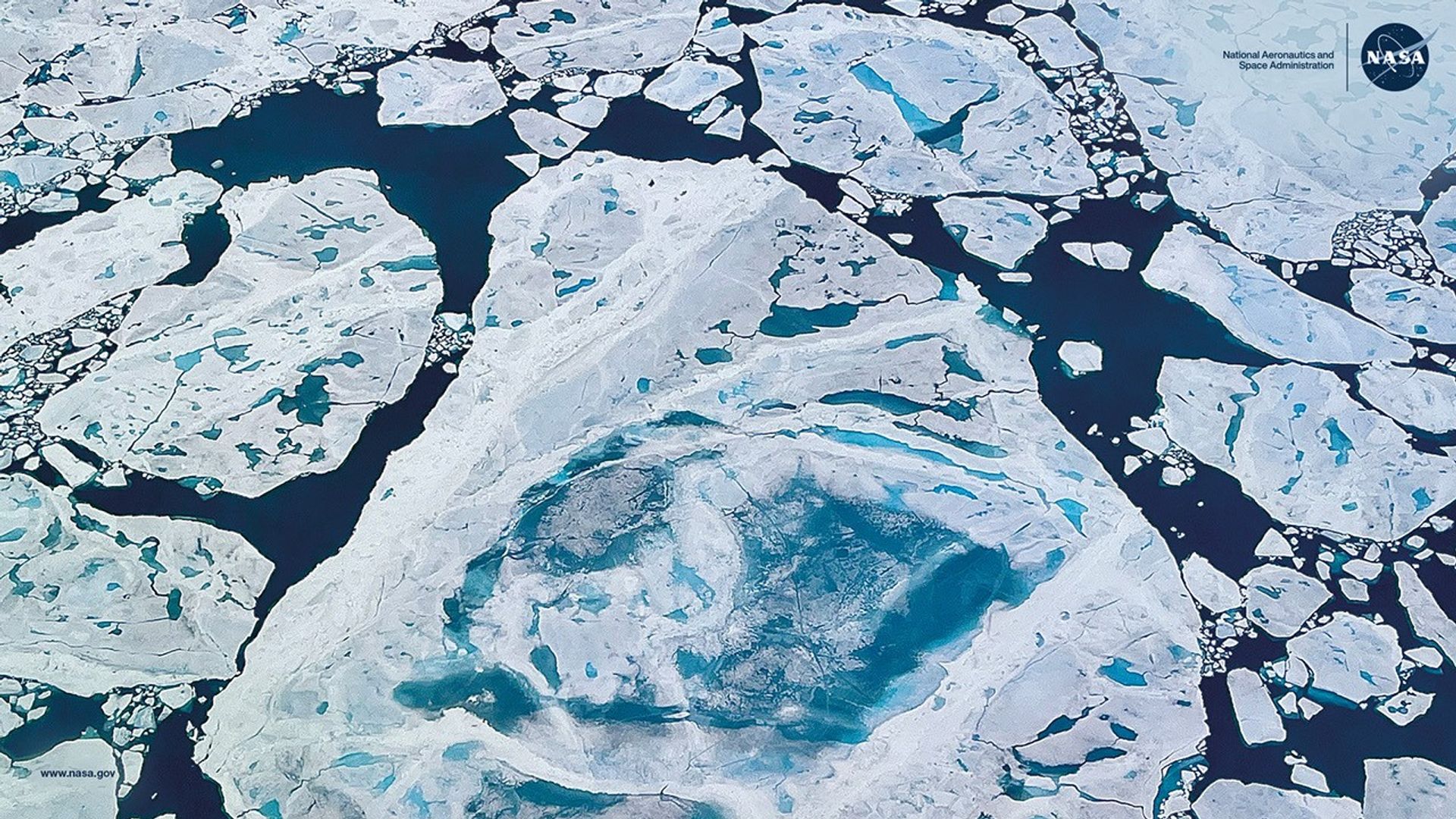
Thinning Arctic Sea Ice
-
Sea ice is frozen seawater that floats in the ocean. This photo, taken from NASA’s Gulfstream V Research Aircraft on July 21, 2022, shows Arctic sea ice in the Lincoln Sea north of Greenland.
Image and text credit: NASA’s Goddard Space Flight Center/ICESat-2/Rachel Tilling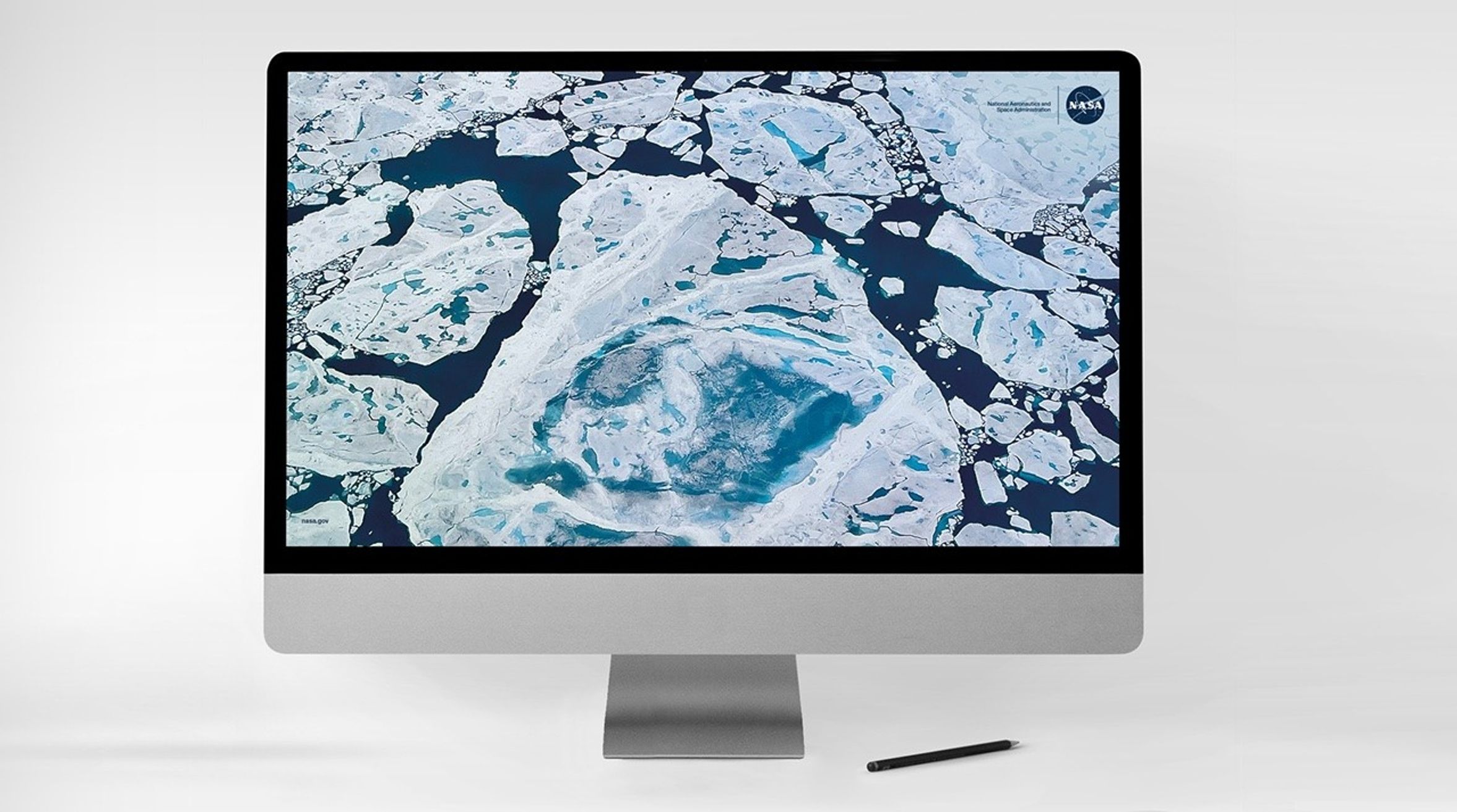
Do NASA Science!
-
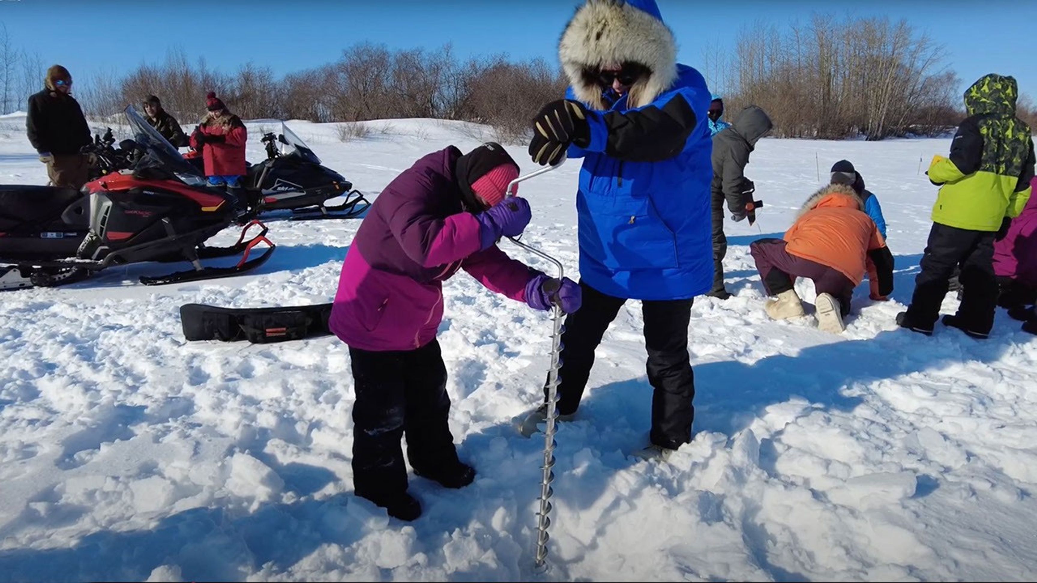
Do you live in Northern North America? Join the Fresh Eyes on Ice project and help scientists study ice!
The Fresh Eyes on Ice project asks you to make observations of river ice in Canada, Alaska, and other parts of North America to enable community safety and climate science. Your observations provide information for fishers, hunters, and travellers.
Discover More about Arctic Sea Ice
Daily Polar Sea Ice, Two Year History
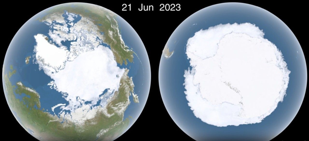
This visualization shows the daily Arctic and Antarctic sea ice and seasonal land cover change over a two-year history from the present.
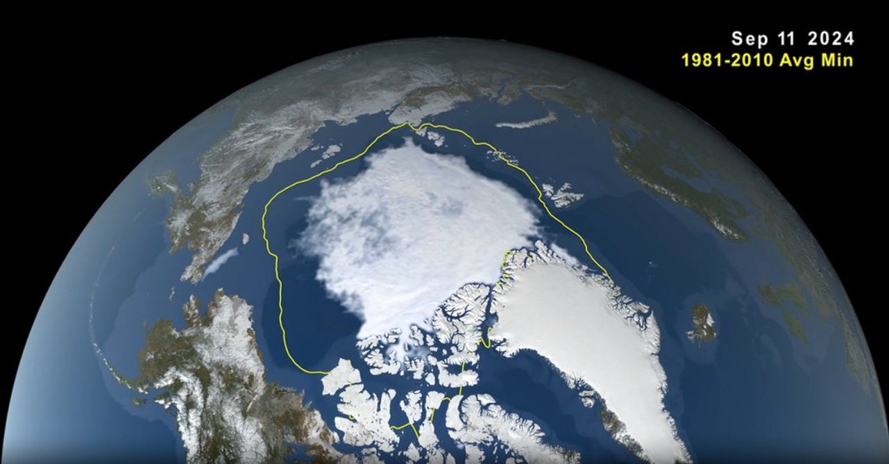
Arctic Sea Ice Minimum 2024
Animation of Arctic sea ice maximum extent, March 14 2024, to its minimum, September 11, 2024.
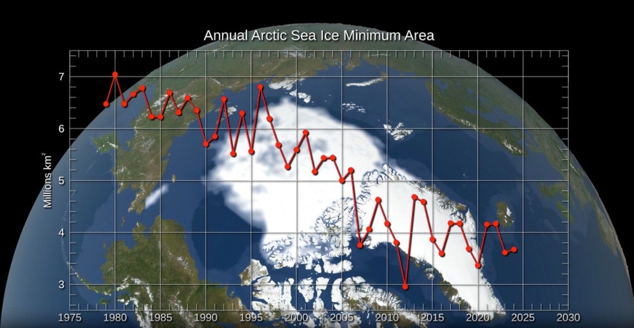
Annual Arctic Sea Ice Minimum Area 1979-2024, With Graph
Satellite-based passive microwave images of sea ice have provided a reliable tool for continuously monitoring changes in the Arctic ice since 1979.
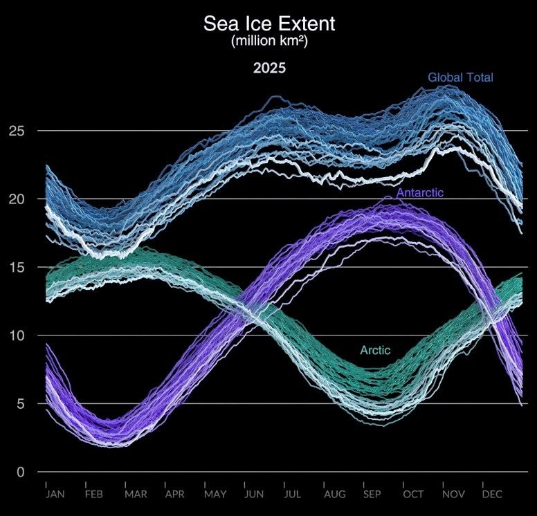
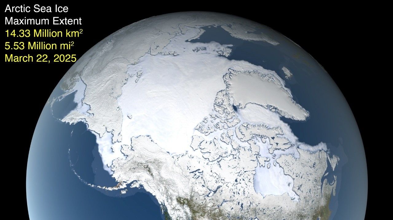
Sea Ice Extent 1978-2025
A visualization of global sea ice extent starting in November 1978 and going through March 2025.
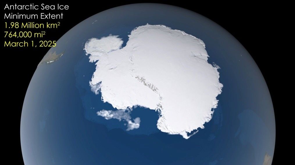
Antarctic Sea Ice Minimum, 2025
On March 1, 2025, Antarctic sea ice officially reached its minimum extent for the year.
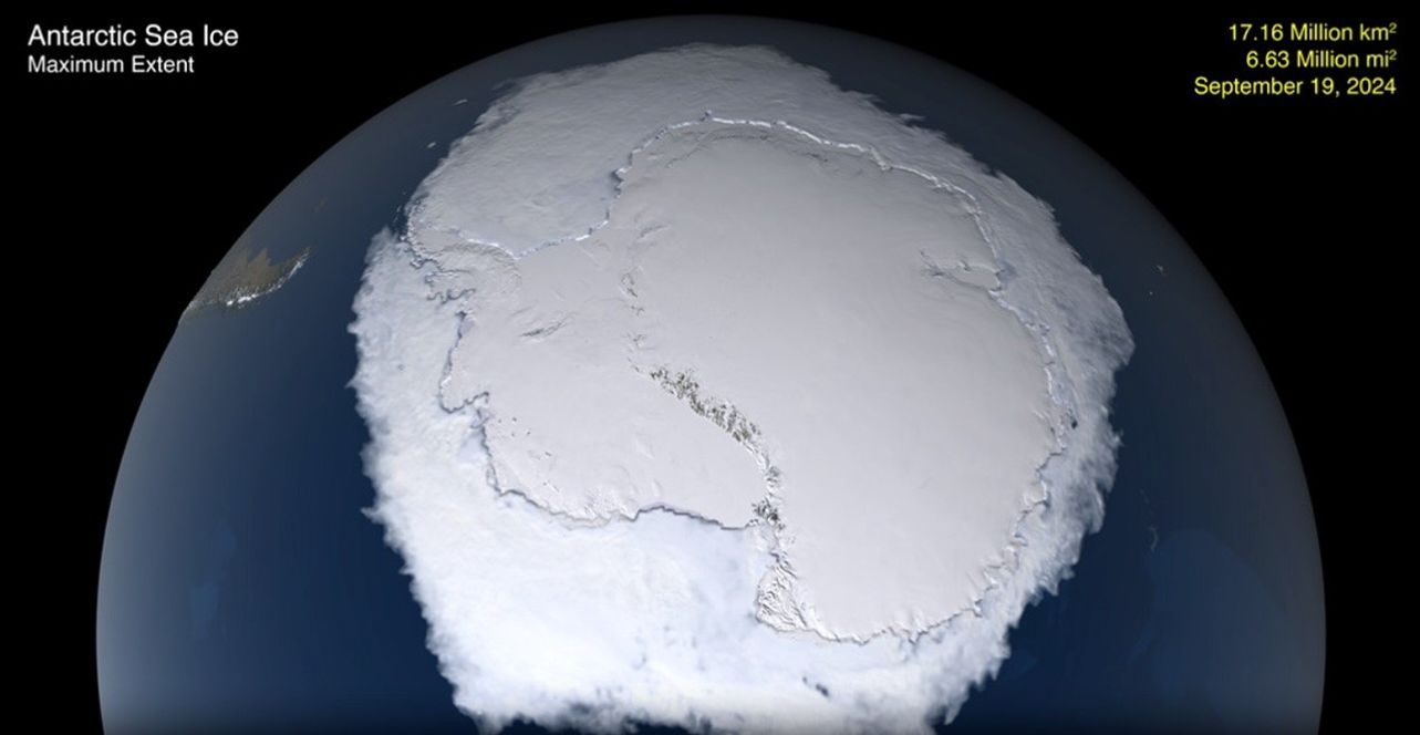
Antarctic Sea Ice Maximum, 2024
Animation Antarctic sea ice minimum extent, February 21 2023, to its maximum, September 19 2024.
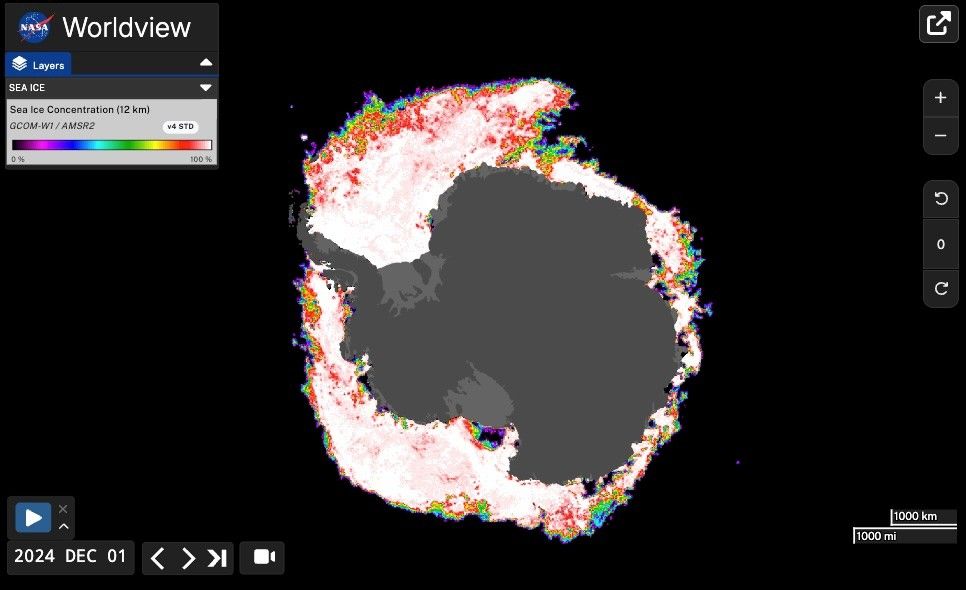
Antarctic Sea Ice Concentration, 2024
Vivid still image showing the continent as negative space and the ice in false color based on concentration.
Science on a Sphere: Global Sea Ice
This visualization shows daily Arctic and Antarctic sea ice and seasonal land cover change over a two-year period between 2023 and 2024.
Sea Ice on Earth Observatory
Sea ice is frozen seawater that floats on the ocean surface. It forms in both the Arctic and the Antarctic in each hemisphere’s winter.

The Science of ICESat-2
ICESat-2 provides scientists with height measurements of glaciers, sea ice, forests and more.
Activities and Games


2025 NASA Science Calendar
Download our latest calendar and wallpaper backgrounds for your desktop or mobile device, and discover the fascinating science behind the images featured each month.
Download Options
Explore our other featured images
January 2025
February 2025
March 2025
April 2025
May 2025
June 2025
July 2025
August 2025
September 2025