Bruce Chapman
Scientist - NASA's Jet Propulsion Laboratory (JPL)
Contents
- Education
- What first sparked your interest in space and science?
- How did you end up working in the space program?
- Tell us about your job. What do you do?
- What's one piece of advice you would give to others interested in a similar career?
- What have been some of your favorite projects to work on?
- What is your favorite space image and why?
- Where are they from?
Education
Scottsdale High School, Scottsdale, Arizona
University of California, Berkeley, CA
Physics and Astronomy
Massachusetts Institute of Technology, Cambridge, MA
Earth, Atmospheric, and Planetary Science
What first sparked your interest in space and science?
My 5th-grade teacher (whose name I, unfortunately, do not remember), in Daly City, California, praised how well I did on a science test in front of the class! I had never been praised like that by a teacher for doing well on anything. I wondered, “Is science something I am particularly good at learning?”
In 7th grade, another teacher (not a science teacher) encouraged us to see science as a work in progress – not just to be read and understood – but something that we could participate in.
How did you end up working in the space program?
My research advisor in grad school had worked on several NASA projects, and I listened with great interest about his experiences. It sounded very exciting, so I applied to NASA’s Jet Propulsion Laboratory (JPL) when I was close to finishing my thesis.
Tell us about your job. What do you do?
I work at JPL where we use images from radar data to study Earth’s landscape in a different way than from optical imagery. Currently, I am on the science team for an upcoming Earth-orbiting radar mission called NASA ISRO SAR, or NISAR. My main interest is ensuring that the NISAR imagery can be used to create maps of where standing water is present, including those areas obscured by vegetation. I am also leading the overall science measurement validation activities for NISAR.
What's one piece of advice you would give to others interested in a similar career?
Learn about internships. I wish I had known more about all the great internship programs NASA has when I was in school. It is a great way to find out what it is like to work at a NASA center.
What have been some of your favorite projects to work on?
For many years, I have worked on airborne radar projects like NASA’s Airborne Synthetic Aperture Radar (AIRSAR) and Uninhabited Aerial Vehicle Synthetic Aperture (UAVSAR).
With airborne projects, anything can happen. You are often collecting unique data sets years in advance of collecting the same type of data from satellites. With airborne data collections, there are many things that could go wrong: Air traffic control might divert the flight; the weather could turn bad; the plane might need to be repaired; or something could go wrong with the data collection. It is a great challenge. It requires many people with different skills to work well together for success.
What is your favorite space image and why?
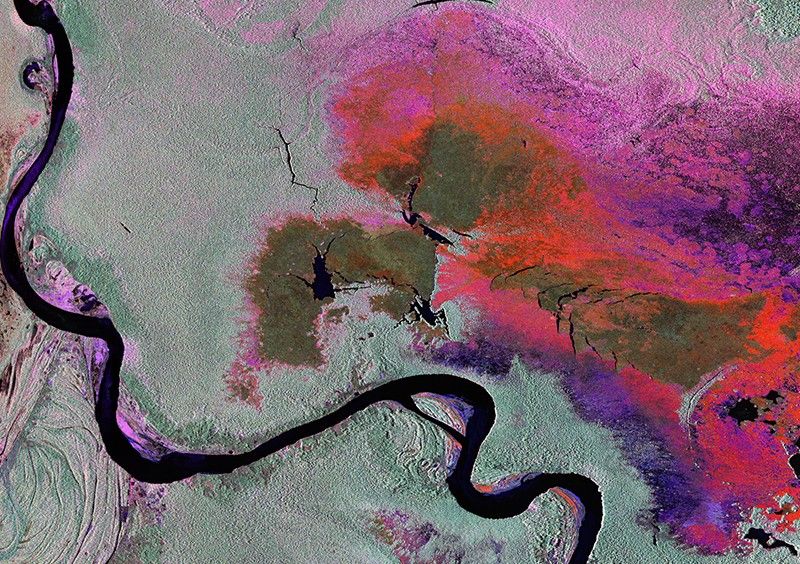
This radar image was acquired by UAVSAR in 2013. The image shows a huge wetland area in Peru called the Pacaya Samiria. It has been processed so that the colors of the image are a function of how the radar waves scatter off the forests and water.
Where are they from?
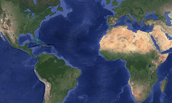
Planetary science is a global profession.


