


Description
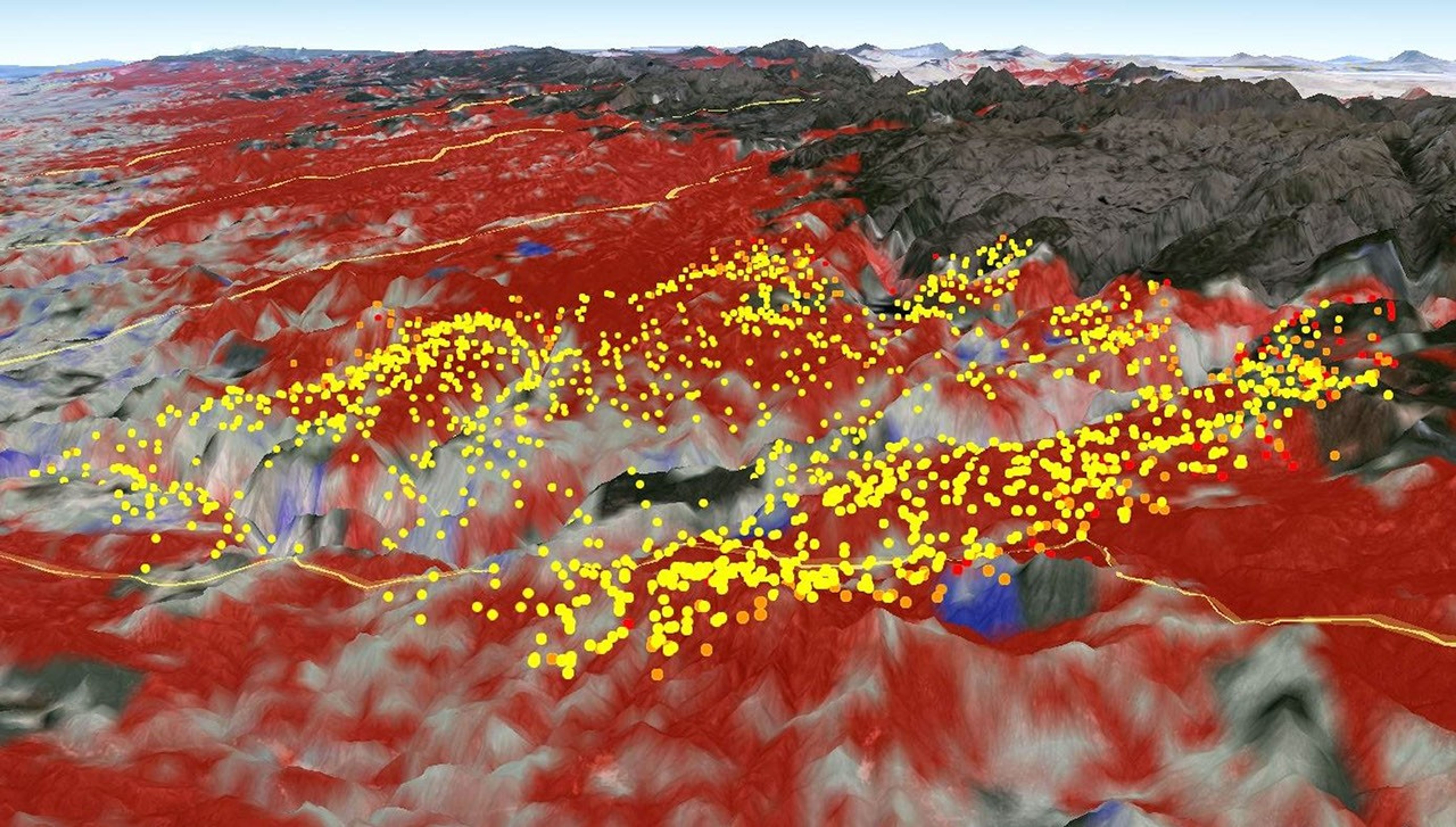
Measurements from the Moderate Resolution Imaging Spectroradiometer (MODIS) instrument aboard NASA's Aqua satellite were used assess fire danger in California's Stanislaus National Forest (Yosemite National Park) by monitoring live fuel moisture, which is the amount of water contained in vegetation. In this satellite image, the red areas seen by MODIS revealed that live fuel moisture had excessively dried up by more than 50 percent prior to the Rim Fire in August 2013. The Rim Fire burned more than 257,000 acres and caused $124 million in damage. Yellow/orange dots marked actual fire locations (data from U.S. Forest Service), which occurred primarily over the red areas, indicating highly elevated fire danger potential identified by MODIS before the fire occurred.


