


![Request for Information – Potential [Placeholder for Prize]](https://assets.science.nasa.gov/dynamicimage/assets/science/psd/solar/2023/09/s/solarsystem_0.jpg?w=1024)


Description
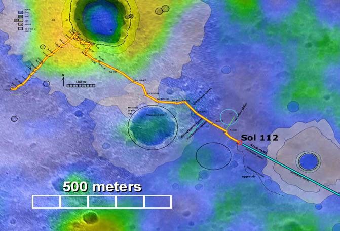
This map highlights the path that NASA's Mars Exploration Rover Spirit has traveled and will continue to travel toward the "Columbia Hills." As of today, sol 114 (April 28, 2004), Spirit has driven about 1,315 meters (.82 miles). Light patches of color surrounding various craters are areas that were predicted to be material ejected from those craters. The predictions were based on observatons from orbit. Spirit's observations of the rocks and soils along this route so far confirm those predictions. The map comprises data from the camera on NASA's Mars Global Surveyor orbiter and the thermal emission imaging system on NASA's Mars Odyssey orbiter.


