


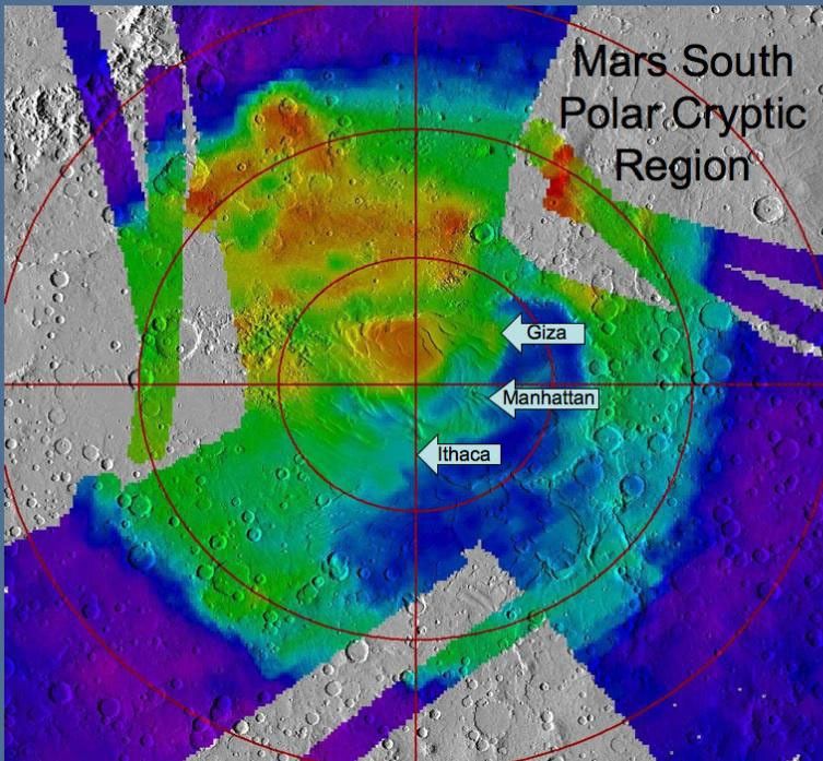
Description
A regional landscape near Mars' south pole is called "cryptic terrain" because it once defied explanation, but new observations bolster and refine interpretations of how springtime outbursts of carbon-dioxide gas there sculpt intricate patterns and paint seasonal splotches. This map indicates locations of three sites that have been examined within the area of cryptic terrain, informally designated "Manhattan," "Giza" and "Ithaca."
The underlying map offers context of brightness measurements from the Thermal Emission Spectrometer instrument draped over a shaded relief map based on data from the Mars Orbiter Laser Altimeter instrument. Cool colors are areas with a low albedo (dark) and warm colors are areas which have high albedo (bright). Both of those instruments flew on NASA's Mars Global Surveyor orbiter.


