


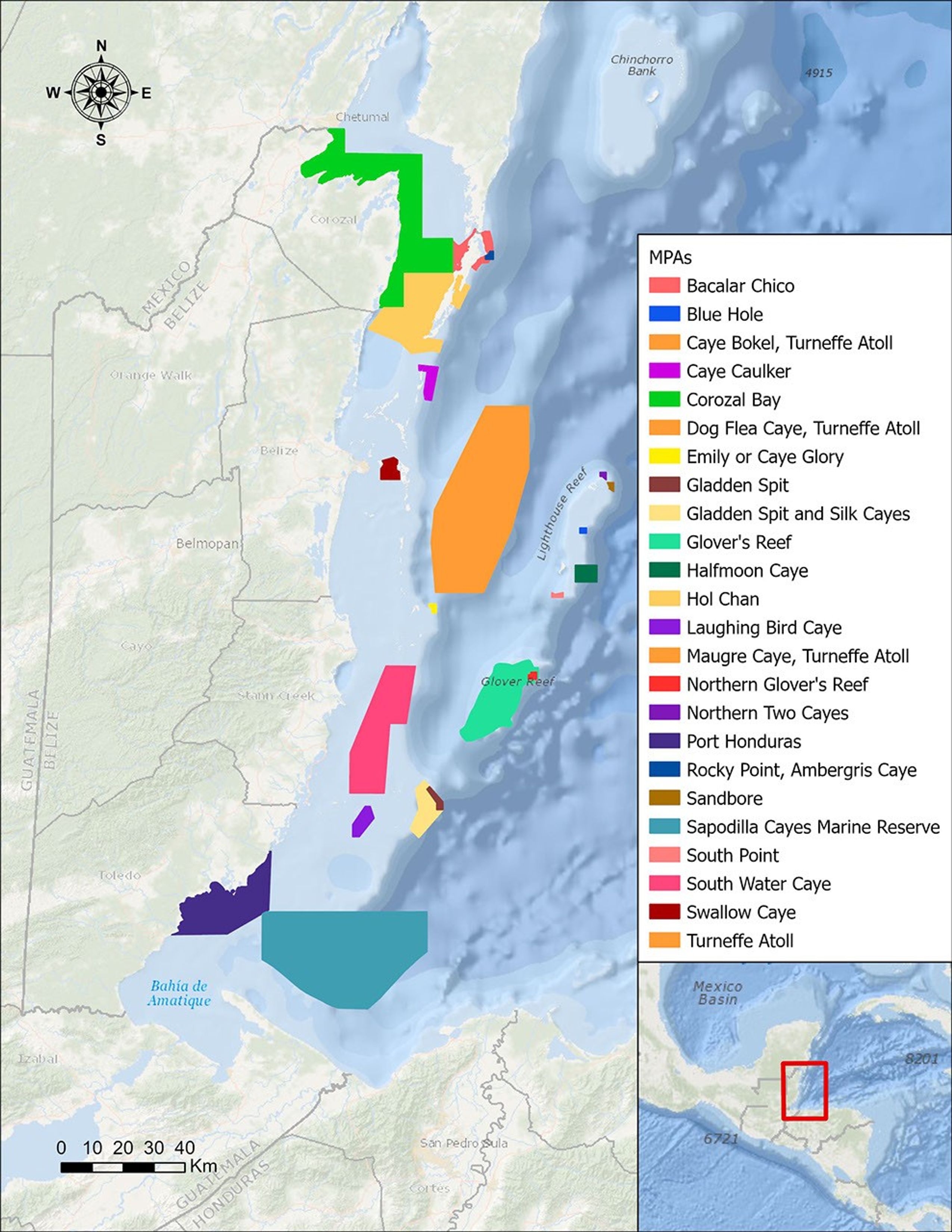

Description
In a paper published in November 2022 in Frontiers in Remote Sensing, researchers at NASA's Jet Propulsion Laboratory, with colleagues in Belize, used data from the Moderate Resolution Imaging Spectroradiometer (MODIS) instrument aboard NASA's Aqua satellite to rank 24 protected marine areas off the Belizean coast based on the risks coral face from murky water and rising temperatures.
All the areas are part of the 185-mile-long (298-kilometer-long) Belize Barrier Reef Reserve System, which encompasses a vibrant network of marine environments that supports thousands of animal and plant species and drives the Central American country's largest industry, tourism. The system is one of about 1,200 UNESCO World Heritage sites around the world.
Analyzing imagery from 2002 to 2022, researchers developed a coral vulnerability index – a score between 2 and 12 that characterizes the risk to coral, with higher scores signifying greater risk. Their findings could help management authorities protect the reefs from human impacts such as development, overfishing, pollution, and climate change.
Port Honduras Marine Reserve, a 156-square-mile (40,000-hectare) protected area in southern Belize, showed the highest coral vulnerability score: 10 out of 12. Based on the index, the study flags Port Honduras, Swallow Caye Wildlife Sanctuary, Sapodilla Cayes Marine Reserve, and Corozal Bay Wildlife Sanctuary as areas for concern.
For more about MODIS: modis.gsfc.nasa.gov


