


Description
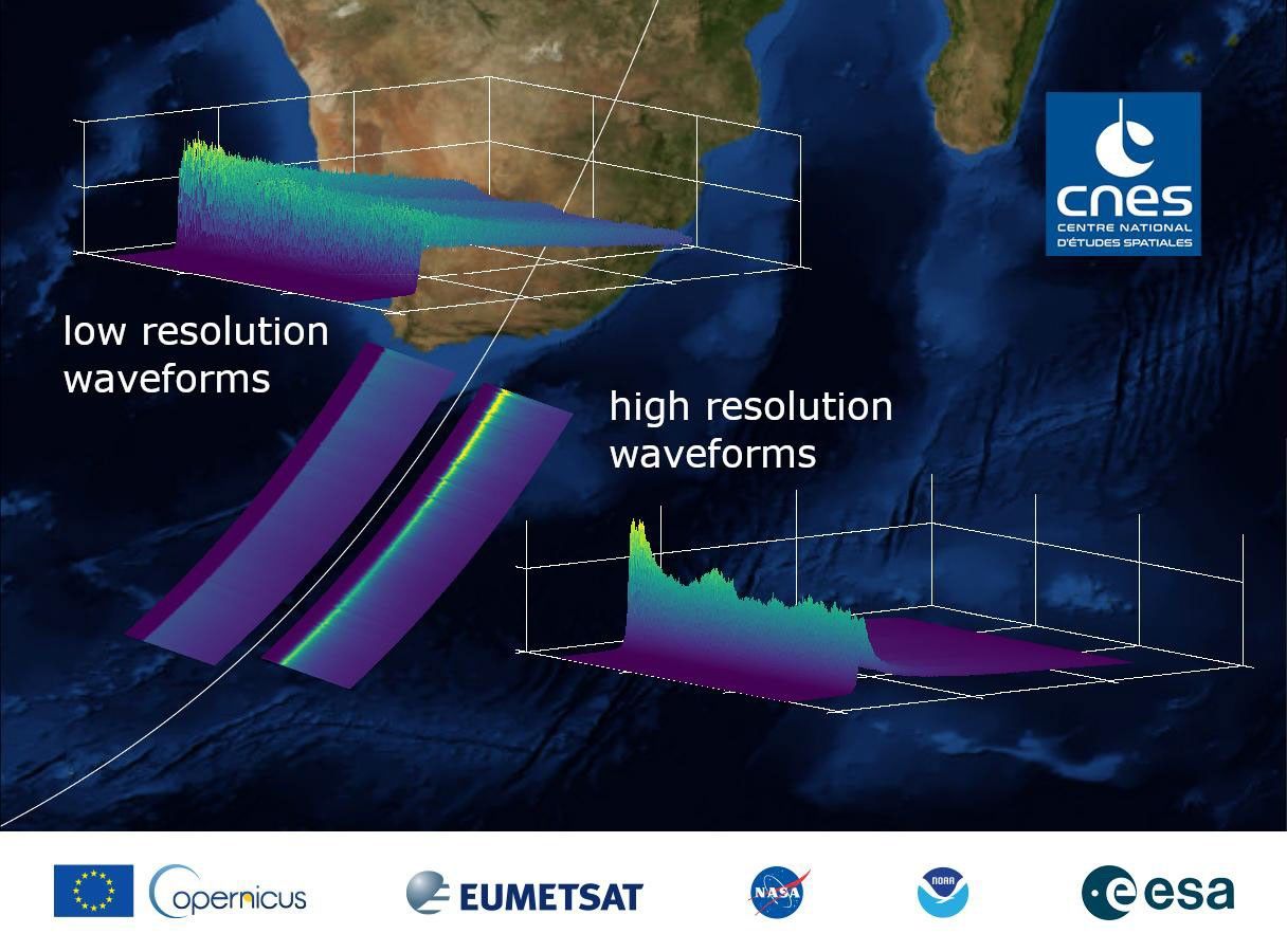
This graphic, released on Dec. 10, 2020, shows the basic radar measurements, called waveforms, collected by the instrument that monitors sea level on the Sentinel-6 Michael Freilich satellite, which launched Nov. 21, 2020. The instrument, called an altimeter, works by bouncing a radar signal off the ocean surface and measuring how long it takes to go out and return. The higher-resolution waveforms focus on a smaller area of the ocean than the lower-resolution waveforms, allowing researchers to resolve smaller ocean features such as currents closer to the coast. The waveform provides information not only on sea level, but also on wave height and wind speed.


