


Description
Map Projected Browse Image
Click on the image for larger version
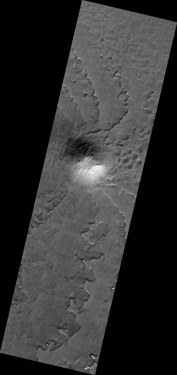
This hill in the South Polar layered deposits has influenced the erosion of the icy layers as seen by NASA's Mars Reconnaissance Orbiter. The hill protects the layers from erosion, so the pattern of erosion to the sides of the hill forms a beautiful spiral pattern.
The map is projected here at a scale of 50 centimeters (19.7 inches) per pixel. [The original image scale is 49.7 centimeters (19.6 inches) per pixel (with 2 x 2 binning); objects on the order of 149 centimeters (58.6 inches) across are resolved.] North is up.
The University of Arizona, Tucson, operates HiRISE, which was built by Ball Aerospace & Technologies Corp., Boulder, Colo. NASA's Jet Propulsion Laboratory, a division of Caltech in Pasadena, California, manages the Mars Reconnaissance Orbiter Project for NASA's Science Mission Directorate, Washington.


