


Description
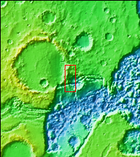
Context image
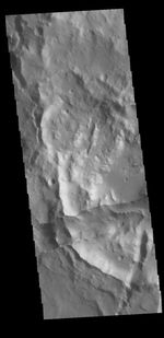
This image shows a portion of the margin between the higher elevations of Xanthe Terra and the lower elevations of Hydraotes Chaos. The linear depression in the bottom half of the image is a graben, a tectonic feature created by the movement of a block of material downward along paired faults.
Orbit Number: 63448 Latitude: 1.18728 Longitude: 321.641 Instrument: VIS Captured: 2016-04-03 02:31
Please see the THEMIS Data Citation Note for details on crediting THEMIS images.
NASA's Jet Propulsion Laboratory manages the 2001 Mars Odyssey mission for NASA's Science Mission Directorate, Washington, D.C. The Thermal Emission Imaging System (THEMIS) was developed by Arizona State University, Tempe, in collaboration with Raytheon Santa Barbara Remote Sensing. The THEMIS investigation is led by Dr. Philip Christensen at Arizona State University. Lockheed Martin Astronautics, Denver, is the prime contractor for the Odyssey project, and developed and built the orbiter. Mission operations are conducted jointly from Lockheed Martin and from JPL, a division of the California Institute of Technology in Pasadena.


