Curiosity Heading Away from ‘Pahrump Hills’

| Credit | NASA/JPL-Caltech/Univ. of Arizona |
|---|---|
| Language |
|
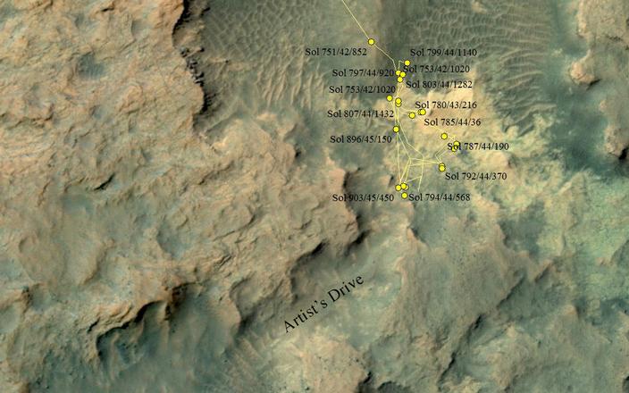
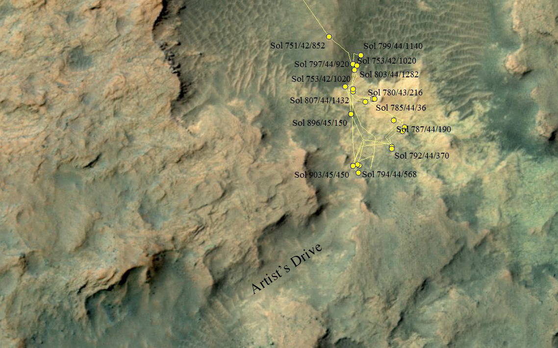
This area at the base of Mount Sharp on Mars includes a pale outcrop on the right, "Pahrump Hills," where NASA's Curiosity Mars rover worked for nearly six months, and the "Artist's Drive" route toward higher layers of the mountain.
The map covers an area about 300 yards (275 meters) across. North is up. The yellow lines indicate the route driven by Curiosity between Sol 751 (the 751st Martian day of the mission, on Sept. 16, 2014) and Sol 903 (Feb. 19, 2015). The rover stayed at the Sol 903 location for three weeks, during drilling of rock target "Telegraph Peak" and analysis of a short circuit that occurred during transfer of rock powder acquired during that drilling. The mission's investigation of Pahrump Hills included three passes up the outcrop. The first was a "walkabout" scouting pass using the remote-sensing instruments on Curiosity's mast. The second pass used instruments on the arm for more detailed assessments of selected targets. In the final pass, the rover drilled into two rock targets to collect samples for onboard laboratory analysis.
Sample powder from Telegraph Peak was delivered to an onboard laboratory on Sol 922 (March 11, 2015), and the rover drove about 33 feet (10 meters) southwestward on Sol 933 (March 12, 2015). The rover team plans to take Curiosity through the Artist's Drive valley to reach higher geological layers of Mount Sharp.
The base map uses imagery from the High Resolution Imaging Science Experiment (HiRISE) camera on NASA's Mars Reconnaissance Orbiter.
More information about Curiosity is online at http://www.nasa.gov/msl and http://mars.nasa.gov/msl/.

