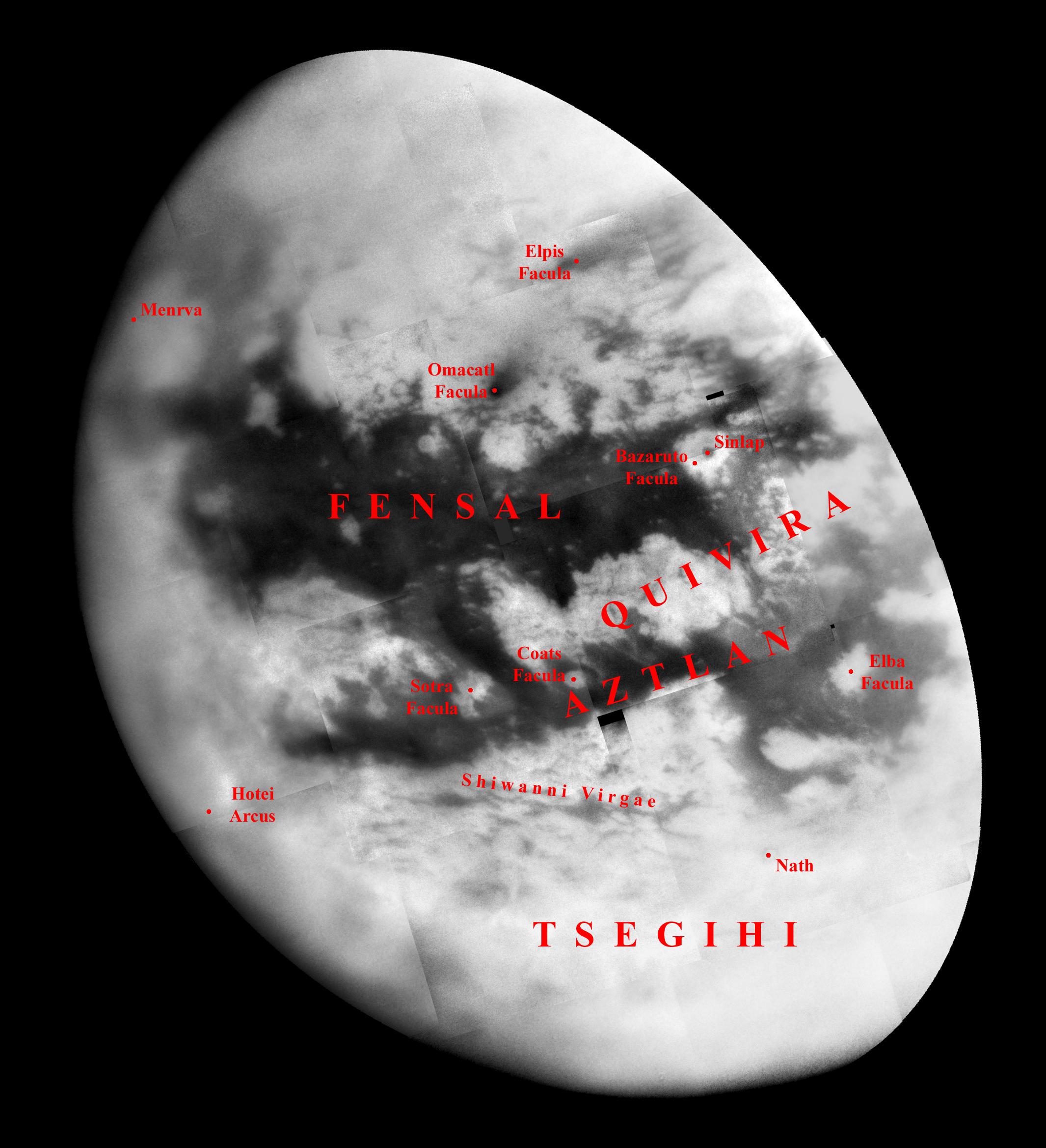
Naming New Lands — September Flyby with Labels

| PIA Number | PIA07753 |
|---|---|
| Language |
|
Like an ancient mariner charting the coastline of an unexplored wilderness, Cassini's repeated encounters with Titan are turning a mysterious world into a more familiar place.
During a Titan flyby on Sept. 7, 2005, the spacecraft's narrow-angle camera acquired multiple images that were combined to create the mosaic presented here. Provisional names applied to Titan's features are shown; an unlabelled version of the mosaic is also available (see PIA07755).
The image shows more than half of Titan's Saturn-facing hemisphere at moderate resolution, including the Fensal-Aztlan region, formerly "the H." This view is centered at 6.5 degrees north latitude, 20.6 degrees west longitude, and has a pixel scale of about 2 kilometers (1 mile) per pixel. It is an orthographic projection, rotated so that north on Titan is up.
This view is composed of 20 images obtained on Sept. 7, 2005, each processed to enhance surface detail. The central portion of this mosaic was previously released without labels (see Monitoring 'Fensal-Aztlan).
The Cassini-Huygens mission is a cooperative project of NASA, the European Space Agency and the Italian Space Agency. The Jet Propulsion Laboratory, a division of the California Institute of Technology in Pasadena, manages the mission for NASA's Science Mission Directorate, Washington, D.C. The Cassini orbiter and its two onboard cameras were designed, developed and assembled at JPL. The imaging operations center is based at the Space Science Institute in Boulder, Colo.
For more information about the Cassini-Huygens mission visit http://saturn.jpl.nasa.gov . The Cassini imaging team homepage is at http://ciclops.org .
Credit: NASA/JPL/Space Science Institute
