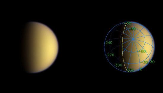
A day after entering orbit around Saturn, Cassini sped silently past Titan, imaging the moon's south polar region. This natural color image represents Cassini's view only about two hours after closest approach to the moon.
The superimposed coordinate system grid in the accompanying image at right illustrates the geographical regions of the moon that are illuminated and visible, as well as the orientation of Titan -- lines of longitude converge on the South Pole above the center of the image. The yellow curve marks the position of the boundary between day and night on Titan.
Images taken through blue, green and red filters were combined to create this natural color view. The images were obtained using the Cassini spacecraft wide angle camera on July 2, 2004, from a distance of about 347,000 kilometers (216,000 miles) from Titan and at a Sun-Titan-spacecraft, or phase angle of 62 degrees. This view is an improvement in resolution of nearly a factor of four over the previously released natural color view of Titan. The image scale is 21 kilometers (13 miles) per pixel.
The Cassini-Huygens mission is a cooperative project of NASA, the European Space Agency and the Italian Space Agency. The Jet Propulsion Laboratory, a division of the California Institute of Technology in Pasadena, manages the Cassini-Huygens mission for NASA's Office of Space Science, Washington, D.C. The Cassini orbiter and its two onboard cameras were designed, developed and assembled at JPL. The imaging team is based at the Space Science Institute, Boulder, Colo.
For more information about the Cassini-Huygens mission, visit http://saturn.jpl.nasa.gov and the Cassini imaging team home page, http://ciclops.org .
Image Credit:
NASA/JPL/Space Science Institute

