The Rhea Atlas
| PIA Number | PIA12806 |
|---|---|
| Language |
|
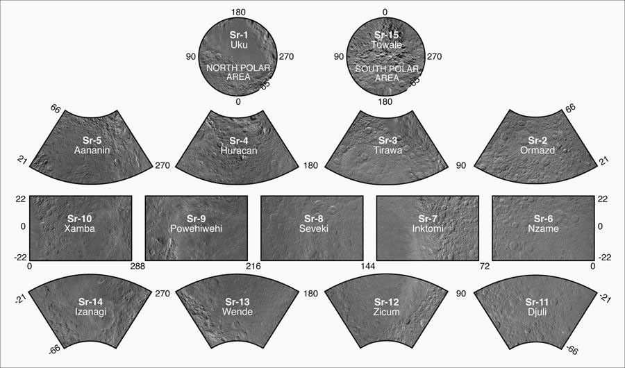
Presented here is a complete set of cartographic map sheets from a high-resolution atlas of Saturn's moon Rhea, made from data obtained by the imaging cameras on NASA's Cassini spacecraft.
The map sheets form a 15-quadrangle series covering the entire surface of Rhea at a nominal scale of 1 to 1,500,000. An index for the atlas is included here. The map data were acquired by the Cassini imaging science subsystem. The mean radius of Rhea used for projection of the maps is 764.1 kilometers (474.8 miles). Names for features have been approved by the International Astronomical Union (IAU).
The Cassini-Huygens mission is a cooperative project of NASA, the European Space Agency and the Italian Space Agency. The Jet Propulsion Laboratory, a division of the California Institute of Technology in Pasadena, manages the mission for NASA's Science Mission Directorate in Washington. The Cassini orbiter and its two onboard cameras were designed, developed and assembled at JPL. The imaging team is based at the Space Science Institute, Boulder, Colo.
For more information about the Cassini-Huygens mission visit http://saturn.jpl.nasa.gov or http://saturn.jpl.nasa.gov/ . The Cassini imaging team homepage is at http://ciclops.org .
Credit: NASA/JPL/Space Science Institute


