Earthquakes
Filters

Satellite-based radar images show where a powerful earthquake in the Yukon, Canada, sent rock, snow, and ice spilling across the…

Data provided by the water satellite are helping to improve tsunami forecast models.

NASA scientists employed a pixel-tracking method to reveal how much the ground shifted during one of the largest documented surface…

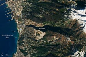
Some parts of the peninsula rose up to 4 meters (13 feet), shifting the position of coastlines and leaving some…
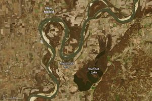
Reelfoot Lake in Tennessee formed as a result of shifts in Earth’s surface.
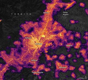
In the days after strong earthquakes struck Türkiye, significant destruction left many areas without electric power.
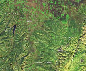
Some towns and farmland were flooded after powerful earthquakes and heavy rains struck areas of Türkiye and Syria. Â
Scientists are using satellite images to locate landslides following the powerful earthquakes that struck in early February.

Scientists from NASA and other agencies are using satellites to map damage caused by the devastating earthquake.