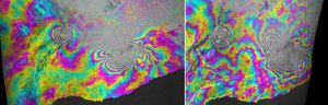
X-band interferometric synthetic aperture radar
Filters
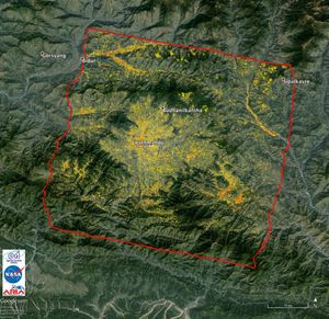
NASA-Generated Damage Map to Assist with 2015 Gorkha, Nepal Earthquake Disaster Response
3 min read
NASA data and expertise are providing valuable information for the ongoing response to the April 25, 2015, magnitude 7.8 Gorkha…
May 1, 2015
Article
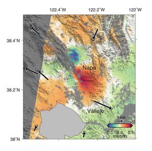
NASA Analyses of Global Positioning System Data and Italian Radar Satellite Data Reveal Napa Quake Ground Deformation
4 min read
A magnitude 6.0 earthquake struck southern Napa county northeast of San Francisco, California, on Aug. 24, 2014. NASA satellite data…
Sep 4, 2014
Article
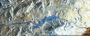
NASA Produces Map to Aid in Italian Flood Response
3 min read
In mid-November 2013, extratropical cyclone Cleopatra brought devastating flooding to the Italian island of Sardinia as shown by the COSMO-SkyMed…
Nov 26, 2013
Article
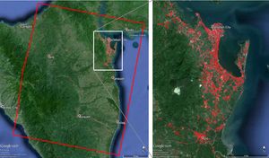
NASA-Generated Damage Map To Assist With Typhoon Haiyan Disaster Response
2 min read
This image, is of Super Typhoon Haiyan, one of the most powerful storms ever recorded on Earth, which struck the…
Nov 13, 2013
Article
INSAR Images Hawaii’s Kilauea Volcano
2 min read
This image using COSMO-SkyMed radar data, depicts the relative deformation of Earth's surface at Kilauea when a large fissure eruption…
Mar 10, 2011
Article