Forests, grasslands, deserts, and mountains are all part of the Patagonian landscape, which spans more than a million square kilometers (about 386,000 square miles) of South America. Toward the western side, expanses of dense, compacted ice—the Patagonian icefields—stretch for hundreds of kilometers atop the Andes mountain range in Chile and Argentina.
The northern and southern lobes of the Patagonian icefield are what’s left of a much larger ice sheet that reached its maximum size about 18,000 years ago. Though just a fraction of their previous size, the modern icefields remain the largest expanse of ice in the Southern Hemisphere outside of Antarctica. But rapid change is ongoing. “They are, in fact, melting away at some of the highest rates on the planet,” said Eric Rignot, a glaciologist at NASA’s Jet Propulsion Laboratory and the University of California-Irvine.
Meltwater from the Patagonian icefield contributes to sea level rise. The contribution is less than what will come from Greenland and Antarctica, but scientists plan to keep studying the region from space, from the air, and from the ground. According to Rignot: “Understanding the evolution of these glaciers helps us understand what glaciers in Greenland and Antarctica may look like in the future in a much warmer climate.”
The images below highlight this dynamic region. Click on the links for even more insight about each icefield and its glaciers.
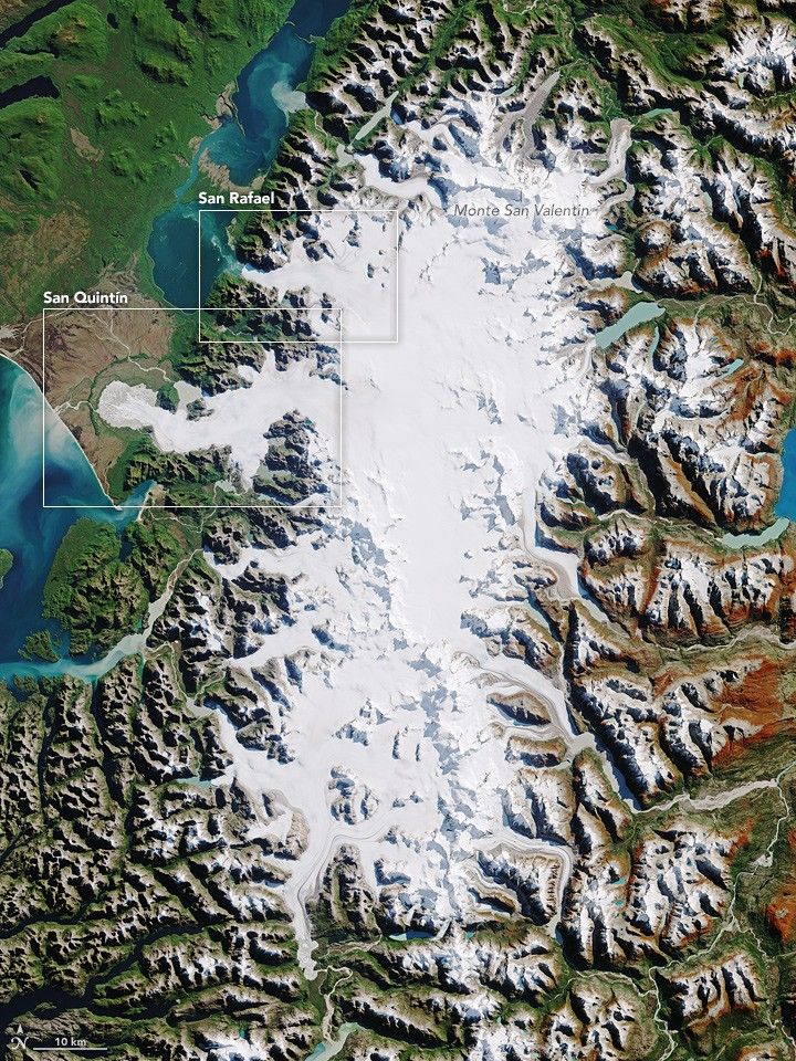
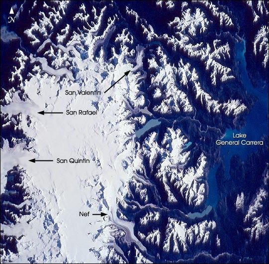
Northern Patagonian Icefield
The northern remnant is the smaller of the two icefields, covering about 4,000 square kilometers (about 2,500 miles). It has 30 significant glaciers along its perimeter, including San Rafael and San QuintÍn. Read more...
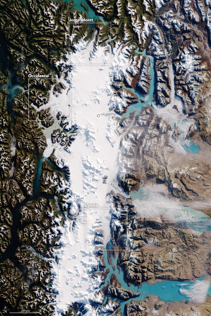
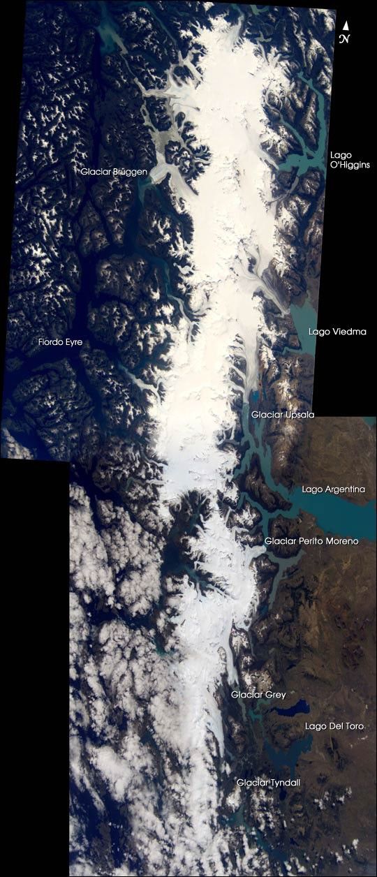
Southern Patagonian Icefield
The southern icefield spans about 13,000 square kilometers (about 8,000 miles), more than three times larger than the northern section. Iceberg-choked fjords and glaciers that flow along the flank of an active volcano are just a few of the highlights. Read more...
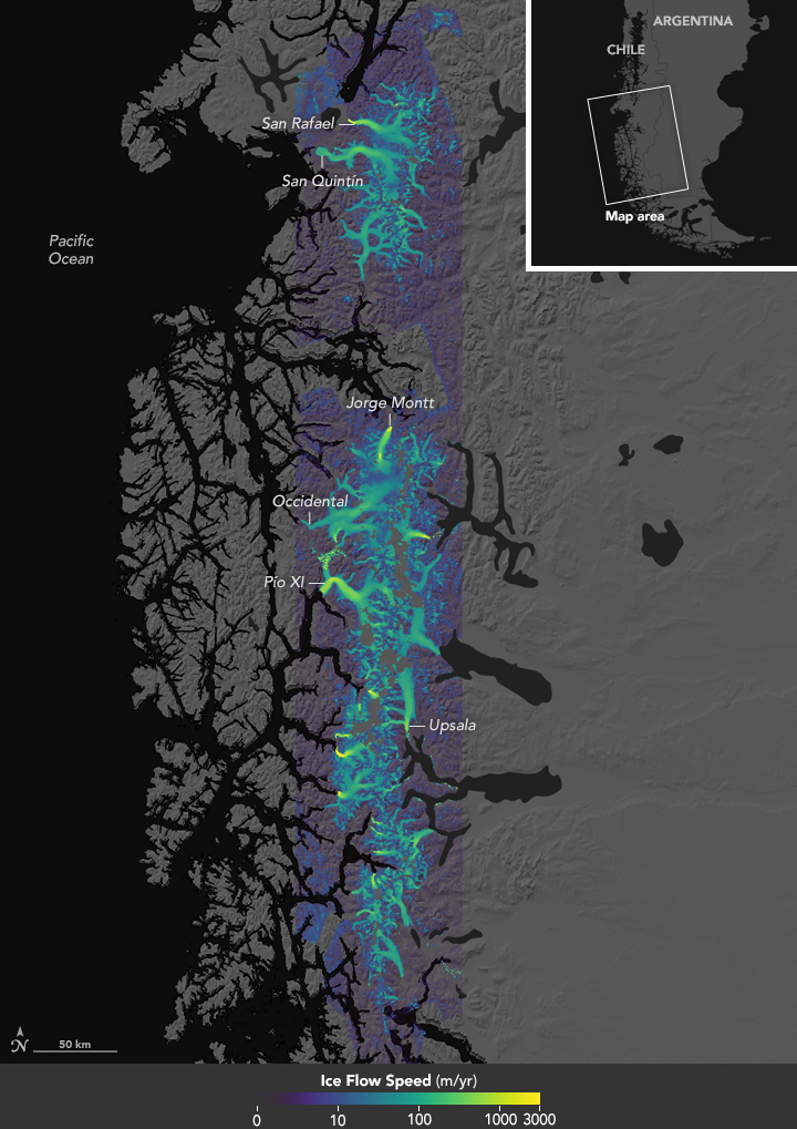
Ice on the move
Ice is moving at vastly different speeds across Patagonia, from a few centimeters (about an inch) to 10,000 meters (about 33,000 feet) per year. In this map, yellow areas are moving fast and purple areas are slow. Notice the significant amount of green; almost half of the ice is moving at speeds faster than 100 meters per year (over 300 feet). Read more...
Other images of Patagonia
Glacial retreat at a non-glacial pace
The HPS-12 glacier in Chile has lost about half of its length in three decades. Read more...
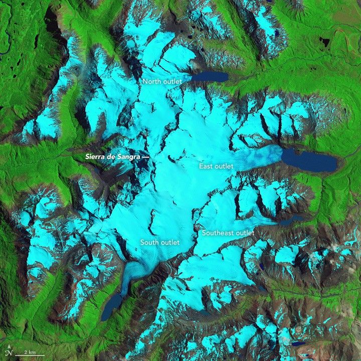
Retreat of the Sierra de Sangra Glaciers
Ice loss in Patagonia has struck more than just the largest and most frequently studied icefields. Read more...
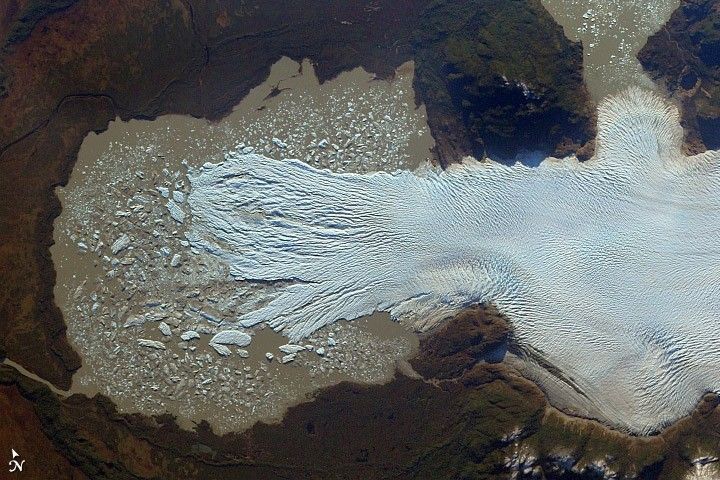
Glaciar San QuintÍn, Chile
The largest outflow glacier in the Northern Patagonian Icefield appears to be shrinking. Read more...
Southern Patagonian Icefield
Straddling the southern Andes Mountains in Chile and Argentina, these glaciers have thinned significantly in the past four decades. Read more...
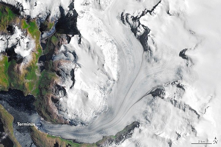
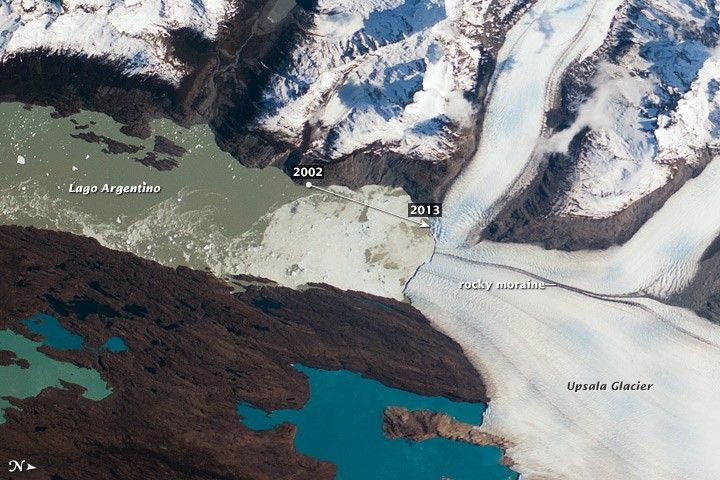
Upsala Glacier retreat
A photograph by an astronaut on the International Space Station shows a progressively shrinking glacier in the Northern Patagonian Icefield. Read more...
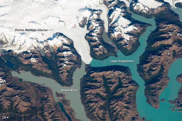
Perito Moreno Glacier, Argentina
One of the most famous glaciers in Patagonia periodically cuts off the major southern arm of Lago Argentino. Read more...
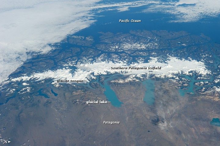
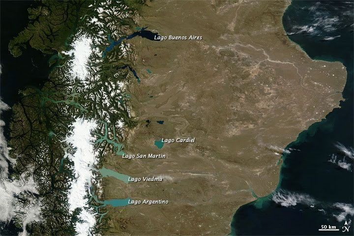
Glacial lakes of Patagonia
This natural-color image shows multicolored glacial lakes extending from Andean glaciers. The lakes extend primarily eastward across the high plain. Read more...
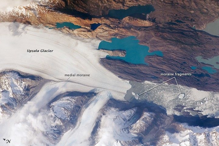
Upsala Glacier, Argentina
Upsala Glacier in the Southern Patagonian Icefield calves icebergs into Lake Argentina in this astronaut photo from October 25, 2009. Read more...
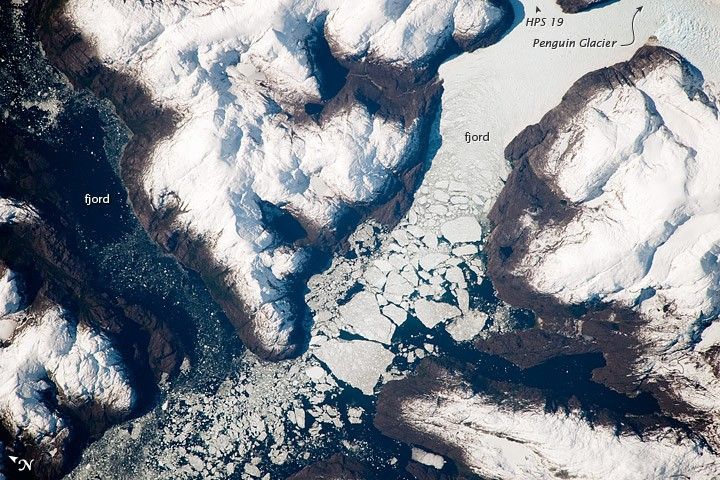
Glacier Outlet, Southern Patagonian Icefield, Chile
This astronaut photograph shows the merged outlet of two glaciers within the deep fjords of the Southern Patagonian Icefield. Read more...
Mosaic of the Southern Patagonian Icefield
Outside of Antarctica, the largest contiguous icefield in the Southern Hemisphere is the Southern Patagonian Icefield in the Andes Mountains of Chile and Argentina. Read more...
Northern Patagonian Icefield, Chile
The Northern Patagonian Icefield is the smaller of two remnant ice masses crowning the Andes Mountains of lower South America. Read more...
This piece was originally published on NASA's Earth Observatory.


