PROJECT
Signals of Opportunity Airborne Demonstrator (SoOp-AD) and SigNals of Opportunity: P-band Investigation (SNoOPI)
KEY POINTS
The SoOP-AD project successfully demonstrated, from aircraft, a new instrument prototype for remote sensing of soil moisture. The SNoOPI project will continue this development by demonstrating this technology from space on a CubeSat platform. Success with SNoOPI will show that this technique is viable in space and would be available for use on future satellite missions.

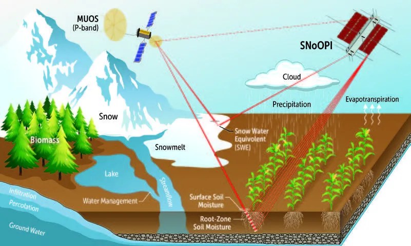
Space-based methods to measure soil moisture on Earth typically entail either sensing the extremely weak emission of microwaves from water in the soil using an instrument call a radiometer or using a radar, which transmits a signal toward Earth, and then receives the signal after it reflects from the soil. Using current technology, neither approach can sense changes in the soil moisture deeper than about five centimeters below the surface.
Plants absorb water down to about a meter below the surface and understanding the full distribution of water in this layer, known as the root zone soil moisture (RZSM), provides a critical link between surface hydrology and deeper processes. Globally mapping RZSM could directly aid our understanding of drainage characteristics, water uptake by plants, food production, and the connection between precipitation and fresh water availability. Our ability to map RZSM is severely limited by the shallow penetration of existing instrument and must rely upon predictions of the soil moisture at deeper levels using a technique known as model assimilation.
The key to sensing deeper into the soil is to use lower frequency radio signals. Unfortunately, this approach is not feasible using existing radiometers and radars, which would require very large (12-30 meter) antennas to meet resolution requirements and would also suffer from interference from other powerful sources (communication signals and space tracking radars) operating on such frequencies.
The Signals of Opportunity Airborne Demonstration (SoOp-AD) project showed that the same communication satellite transmissions that are the sources of this interference penetrate into the soil and reflect from Earth’s surface. By capturing these reflected signals and observing how they changed upon penetrating the soil, scientists can glean information about the RZSM profile at depths of 0 to 30 cm. This technique requires a substantially smaller antenna and results in power requirements that are orders of magnitude lower than traditional active radar, which requires a signal transmitter.
Another store of a large fraction of the Earth’s water is snowpack, which has also proven difficult to measure from space. Similar methods to those demonstrated for RZSM measurement can be applied to sense the quantity of water stored in the snowpack, quantified as the Snow Water Equivalent (SWE).
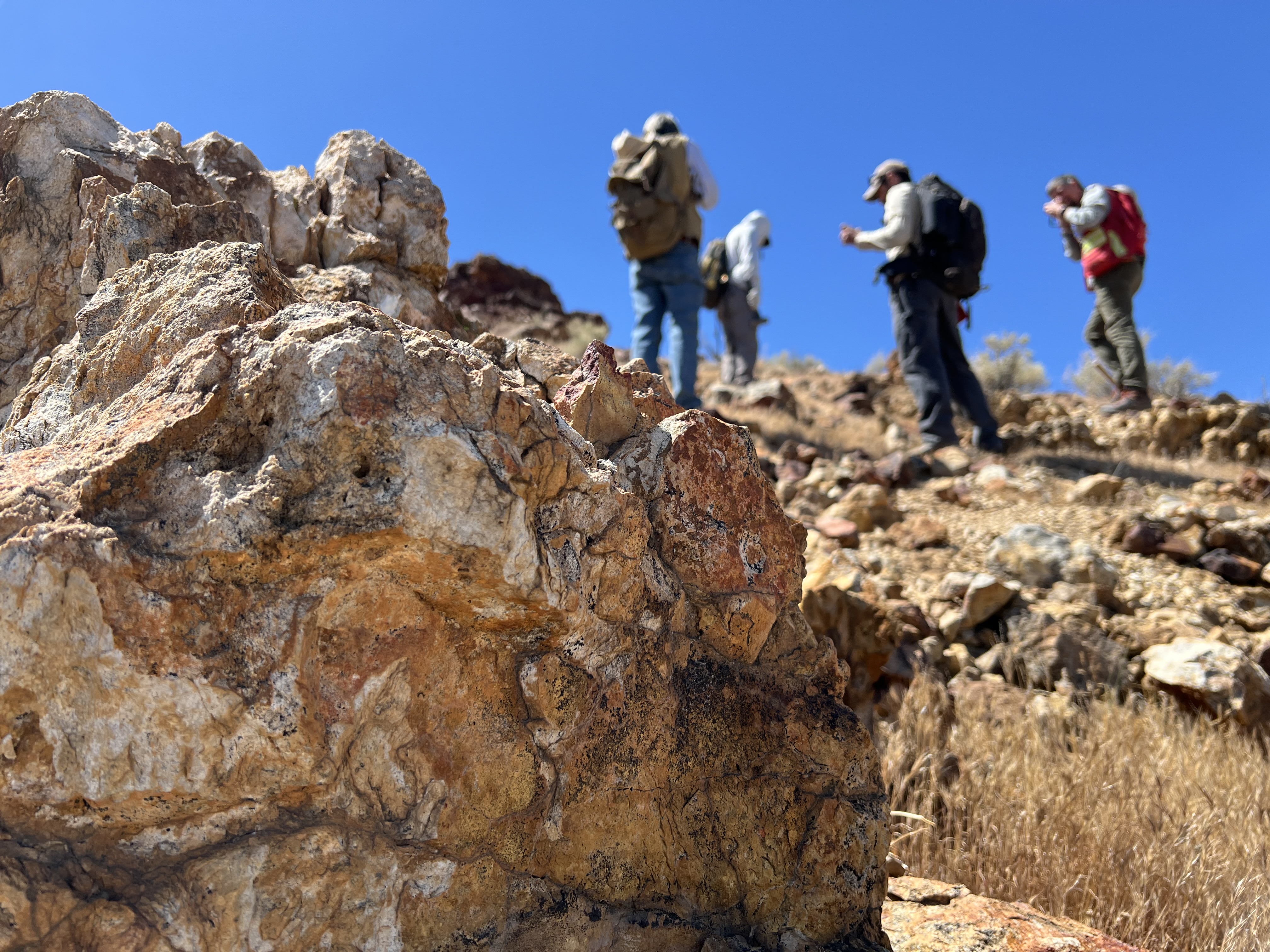
The SoOp-AD instrument was designed and developed by James Garrison at Purdue University and includes a P-band (240 – 270 GHz) and S-band (2332-2345 MHz) receiver system using a dual linear polarization antenna and two four-channel digital receivers. In late 2016, the project team tested the instrument on several flights onboard a NASA B-200 aircraft over instrumented field sites near the Little Washita watershed in Oklahoma. Further field experiments were conducted at the Purdue Agronomy Center for Research and Education (ACRE) to characterize reflected signals and demonstrate soil moisture retrievals under controlled conditions.
These experiments proved SoOp-AD to be a viable approach for next-generation soil measurements from space. PI, James Garrison, notes, “Understanding the water stored in snow and mapping moisture at the root zone are critical for understanding the Earth’s water cycle.” Reutilizing reflected “signals of opportunity” not only allows measurements to be made at previously inaccessible lower frequencies, the method does not require a dedicated transmitter. This approach enables an instrument concept that will be significantly lower in cost, mass, and power consumption than a comparable radar.
Further advancement of the P-band SoOp technique to TRL 6 or higher requires in-space demonstration in relevant environment conditions. On this basis, the project team was awarded a 2017 In-Space Validation of Earth Science Technologies (InVEST) grant to further demonstrate the concept on a CubeSat platform.
The SigNals of Opportunity: P-band Investigation (SNoOPI) will be the first demonstration of the P-band SoOp technique from orbit. SNoOPI will advance the prototype instrument to TRL7 to verify reflection coherence, robustness to the in-orbit radio-frequency interference (RFI) environment, and the ability to capture and process the transmitted signal in space. This demonstration is a necessary risk-reduction step on the path to employing this technology on a space-based science mission.
The SNoOPI instrument consists of three subsystems: a Low Noise Front End (LNFE) developed by NASA Goddard Space Flight Center, Digital Back End (DBE) developed by the NASA Jet Propulsion Laboratory, and antennas. Purdue University will lead the algorithm development and data processing and be responsible for running the Science Operations Center, where the data from the SNoOPI experiment will be collected, processed and evaluated. SNoOPI is scheduled for launch in January 2021.
SPONSORING ORGANIZATION
Earth Science Division’s IIP and InVEST Programs
PROJECT LEAD
Dr. James Garrison, Purdue University