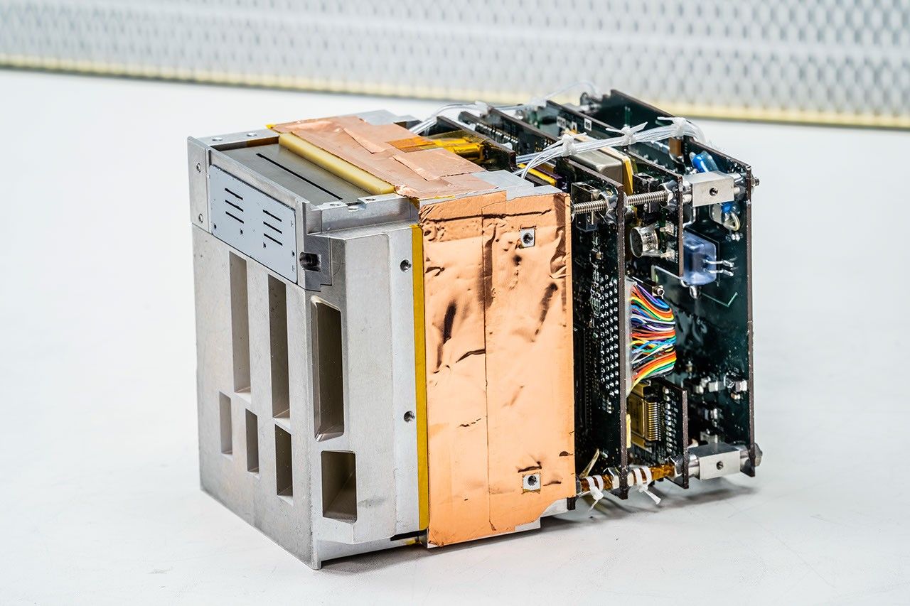
Technology Development: The Wideband (8-40 GHz) Instrument for Snow Measurement (WISM) is designed to accurately measure snowpack on the ground from an airborne platform. WISM is comprised of a dual-frequency (X- and Ku-bands) Synthetic Aperture Radar (SAR) and a dual-frequency (K- and Ka-bands) radiometer. Instead of using individual antenna feeds for each frequency, WISM employs a broadband current sheet array (CSA) antenna feed that enables the integration of the radar and radiometer using a single antenna aperture. Use of this new technology is expected to achieve improved snow measurements, along with significant size, weight, and power advantages over previous systems.

Impact: Seasonal snowpack supplies 50% to 80% of the yearly water supply in the Western United States. To effectively manage water resources, frequent and accurate measurements of the amount of water in the snowpack—the snow water equivalent (SWE)—are critical to understand the very small spatial scales over which the snowpack varies. Eventually, the wideband antenna/ instrument technology demonstrated successfully by WISM could be used in spaceflight applications to provide improved measurements of SWE.
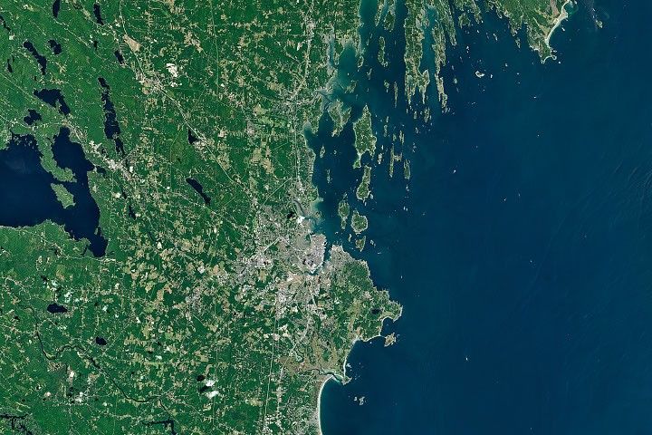
Status and Future Plans: In late February 2015, WISM was installed on a Twin Otter aircraft for a series of demonstration flights over snow-covered areas of Colorado. In 9.4 hours of total flight time, the WISM team collected high-resolution snow data over a broad range of snowpack conditions near Grand Junction, CO, particularly over an experiment site on Grand Mesa. To validate the WISM retrievals, extensive in situ snowpack profiles were also taken using high-resolution groundbased radar and ancillary airborne lidar measurements. These ground observations included 19 detailed snow pits (to determine snow density, temperature, grain size, grain type, and layer thickness profiles), 8,000+ manual depth measurements, and measurements from two snowmobile-based radars that profiled the entire WISM flight line multiple times at 10-cm resolution. On this flight, WISM demonstrated wideband antenna performance, as well as near-simultaneous sensing with both the radar and radiometer.
Sponsoring Organization: The Earth Science Division provided funding for WISM to PI Tim Durham of Harris Corporation via the IIP.