PROJECT
CubeSat Imaging Radar for Earth Sciences (CIRES)
SNAPSHOT
To help monitor ground deformation from space, NASA developed a new technology equipped with an S-band Interferometric Synthetic Aperture Radar (InSAR) for a small satellite platform.
A global map detailing land elevation changes over time can help scientists pinpoint ground motion before, during, and after earthquakes and volcanic eruptions, and help identify impacts from floods and groundwater pumping. A new technology aims to head to space on a small satellite to capture that information for decision makers, scientists, and others.
“The CubeSat Imaging Radar for Earth Sciences, or CIRES, can help decision-makers and emergency managers obtain observations sooner after a hazardous event so that they are better prepared to deal with disaster relief,” said Lauren Wye, the technology’s principal investigator who led and recently concluded its development at SRI International in Menlo Park, California.
CIRES is equipped with an S-band Interferometric Synthetic Aperture Radar (InSAR). The S-band radar is able to penetrate through vegetation and reach the ground. CIRES takes two radar images of a specific area from approximately the same position in space at two different times and then processes the two images to determine the difference between them.
The National Academies of Sciences, Engineering and Medicine’s 2017 Decadal Survey, “Thriving on Our Changing Planet: A Decadal Strategy for Earth Observations from Space,” recommends that NASA use InSAR measurements to help address the dynamics of earthquakes, volcanoes, landslides, glaciers, groundwater, and Earth’s interior.
A constellation of small InSAR satellites could work in tandem with NASA’s first dedicated InSAR satellite—the NASA-ISRO SAR Mission (NISAR), which is currently in development. Multiple small satellites could collect frequent data to investigate rapidly evolving processes like volcanic eruptions, earthquakes, and landslides, adding to NISAR’s systematic global data.
Traditionally, researchers monitor ground deformation with ground-based sensors and the Global Positioning System (GPS). InSAR measurements are complementary to ground measurements and can often guide how ground sensors are installed. “InSAR data have revolutionized how we look at earthquakes and volcanoes,” Kyle Anderson, a geophysicist at the U.S. Geological Survey, said.
In orbit, a series of small InSAR satellites could peer down and record changes in ground deformation. “Volcanoes will often inflate with magma before they erupt,” Anderson said. “Although it’s difficult to predict how big or how long the eruption will be, we can say, this volcano started inflating and there’s a higher probability of it erupting.”
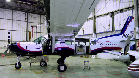
The CIRES project began in January 2015 at SRI International with funding from NASA’s Earth Science Technology Office to develop the instrument’s radar electronics hardware over two years. It then received an additional three years of funding to prepare the radar for space, demonstrate the imaging capabilities via aircraft, including both onboard and remotely piloted aircraft, and advance a space-deployable antenna to complete the instrument.
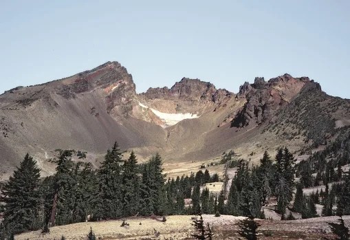
“InSAR has been particularly useful for better understanding volcanoes in remote areas,” Anderson said. For example, the technology helped scientists notice deformation near the Three Sisters cluster of volcanoes in central Oregon from 1997 to 2001. InSAR pinpointed deformation in an area that last saw an eruption 1,500 years ago. Because of the observed changes, the U.S. Geological Survey (USGS) installed seismometers, GPS stations and gas-monitoring equipment to check for other signs of activity. In 2004, those instruments detected a swarm of 300 small earthquakes. “InSAR allows you to get wide areas of coverage and see how one part of the volcano’s caldera is changing relative to another part,” Patrick Rennich, the CIRES signal processing and experiment design lead, said. Typically, researchers place a limited number of GPS sensors on specific parts of the volcano to monitor any movement. “CIRES should be able to cover the entire caldera,” Rennich said.
For the team to make CIRES, or a CIRES-like instrument work in space, they will need to significantly extend its antenna, from two feet across to 10 feet across, Rennich said. “Everything else pretty much stays the same,” he said.
PROJECT LEAD
Dr. Lauren Wye, Aloft Research (formerly with SRI International)
SPONSORING ORGANIZATION
Earth Science Division’s Instrument Incubator Program (IIP)


