![Request for Information – Potential [Placeholder for Prize]](https://assets.science.nasa.gov/dynamicimage/assets/science/psd/solar/2023/09/s/solarsystem_0.jpg?w=1024)


Technology Development
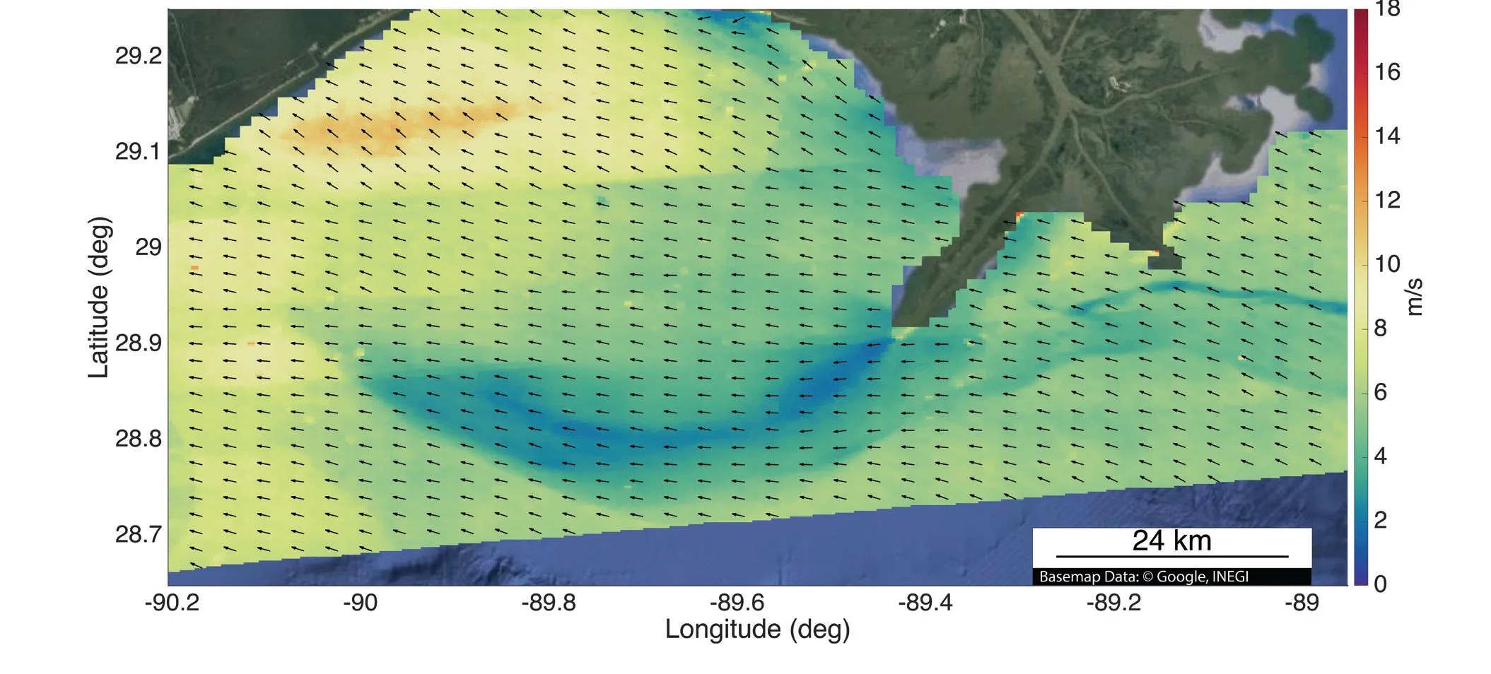
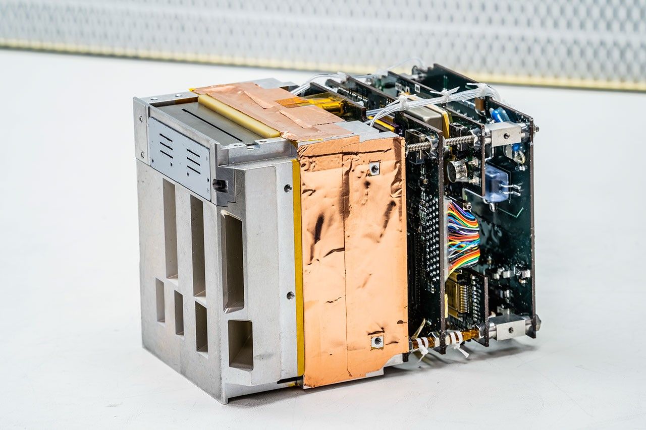
A NASA-developed airborne instrument called DopplerScatt participated in two large-scale oceanographic experiments in April and May of 2017. A Ka-band Doppler scatterometer, DopplerScatt’s ability to take simultaneous measurements of ocean surface winds and water currents is a new science capability—one that could improve our understanding of air-sea interactions and their influence on Earth's climate. Ocean surface currents impact heat transport, surface momentum and gas fluxes, ocean productivity, and marine biological communities. Ocean currents can even have societal impact since they can affect shipping and disaster management. Ocean vector winds are a key variable governing the transfer of momentum, gases, and latent heat between the atmosphere and the ocean. The ability to simultaneously measure ocean winds and currents improves the accuracy of both individual measurements, as there is an intrinsic two-way coupling between them.

In April 2017, DopplerScatt participated in the Submesoscale Processes and Lagrangian Analysis on the Shelf (SPLASH) campaign led by the Consortium for Advanced Research on Transport of Hydrocarbon in the Environment (CARTHE). The goal of SPLASH was to investigate the movement of potential oil spills and leaks in the Gulf of Mexico. For SPLASH, the DopplerScatt team installed the instrument on a King Air B200 aircraft and flew it over the coastal shelf of the U.S. Gulf Coast. DopplerScatt’s measurements complemented in situ data gathered by hundreds of drifting floats and shipborne instruments as well as high-resolution model outputs from the U.S. Naval Research Laboratory. The CARTHE team used DopplerScatt to decide where to place the drifters, and the models and in situ instruments were, in turn, used to further validate DopplerScatt measurements.
In May 2017, DopplerScatt participated in the Keck Institute for Space Studies (KISS) Controlled, Agile, and Novel Ocean Network (CANON) campaign, which isdesigned to optimize robotic sampling capabilities to resolve evolving small-scale ocean instabilities. For the KISS campaign, a team from Caltech/JPL, the Monterey Bay Aquarium Research Institute, and Remote Sensing Solutions collected in situ data in Monterey Bay using different autonomous underwater vehicles and gliders. DopplerScatt provided data to investigate the relationship between the observed Doppler velocities measured by the instrument and currents at various depths.
Impact
While DopplerScatt can be used on future NASA airborne science missions, the technology development also lays the groundwork for an eventual spaceborne instrument, which would enable global measurements of ocean surface winds and water currents simultaneously for the first time.
Future Plans
DopplerScatt is currently funded under NASA’s Airborne Instrument Transition Technology (AITT) Program with the goal of transitioning it to a NASA airborne platform and making it campaign-ready. DopplerScatt is scheduled to collect data along the California coast in spring/summer of 2018.
Sponsoring Organization
The Earth Science Division’s IIP program provided the funding for DopplerScatt development. The Principal Investigator is Dr. Dragana Perkovic-Martin of NASA JPL.