![Request for Information – Potential [Placeholder for Prize]](https://assets.science.nasa.gov/dynamicimage/assets/science/psd/solar/2023/09/s/solarsystem_0.jpg?w=1024)


September 25, 2002
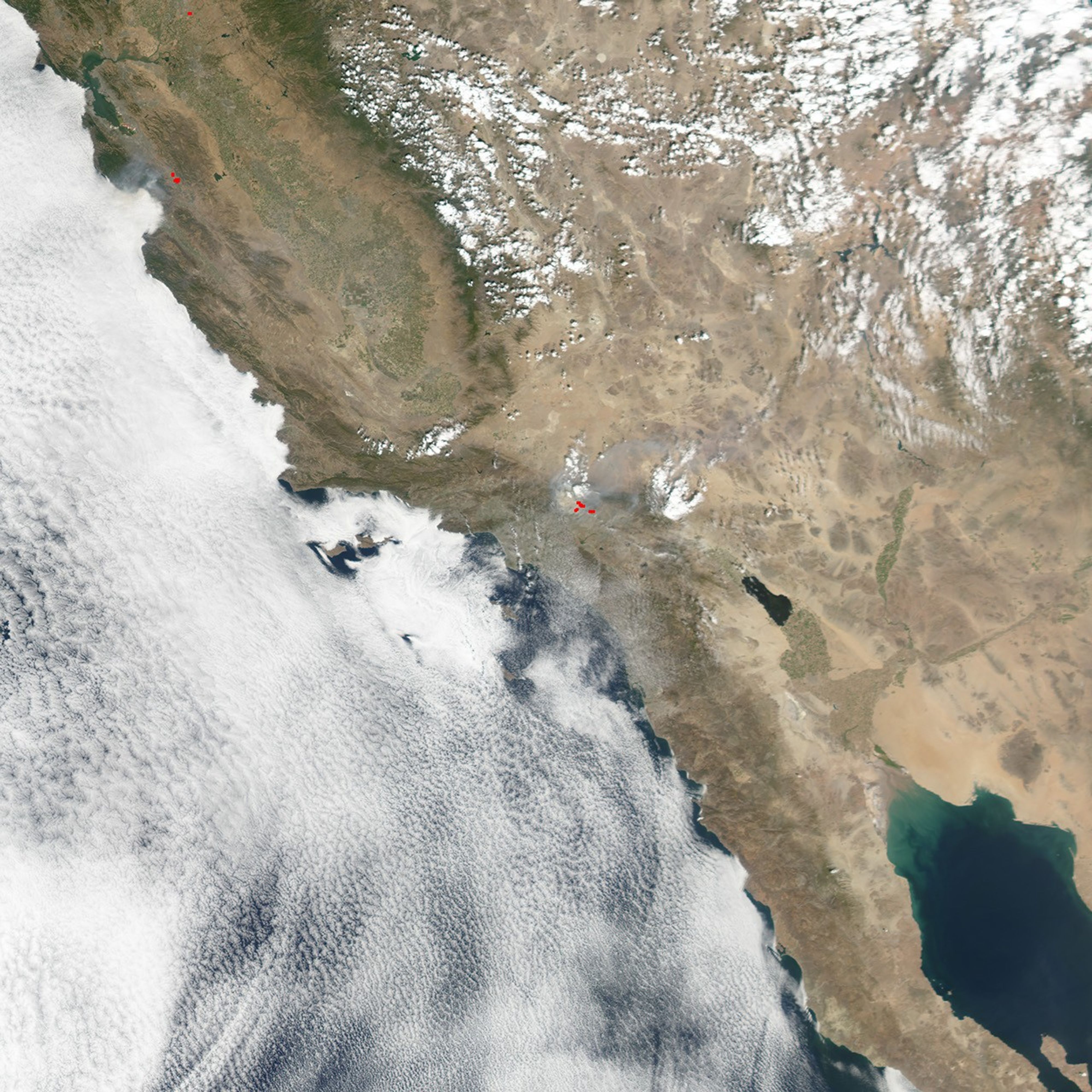
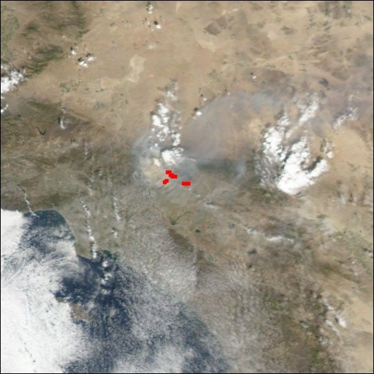
In the San Gabriel Mountains northeast of Los Angeles, the Williams Fire, which began on Sunday evening, September 22, 2002, spread rapidly over the next several days. This true-color image of the fire was captured by the Moderate Resolution Imaging Spectroradiometer (MODIS) on NASA’s Aqua satellite on September 25, 2002. The fire perimeter detected by MODIS is marked with a red outline. The ability of MODIS to detect thermal signatures even through smoke is one of its important contributions to fire management strategies.
References & Resources
Image courtesy Jesse Allen, based on data from the MODIS Land Rapid Response Team at NASA GSFC