


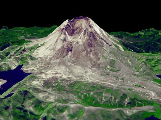

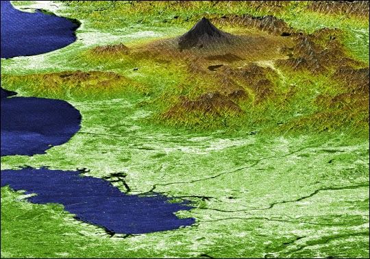
Japan’s Mt. Fuji presents a beautiful backdrop for the city ofTokyo in this perspective view generated using data from theShuttle Radar Topography Mission (SRTM). Occupying most of the imageforeground, Tokyo’s metropolitan area, at about 13,388 squarekilometers (5,169 square miles), is home to more than 32 millionpeople, making it the most densely populated urban area in theworld. Tokyo residents live within striking distance of Japan'stallest volcano, which is also the country's highest point at3,776 meters (12,388 feet). Mt. Fuji is still considered active,although the last major eruption of this perfectly symmetricalstratovolcano came in 1707. Because of its height andspectacular scenery, Mt. Fuji is a favorite for touring, mountainclimbing and hiking. In this image, elevations are represented bycolor; height increases from white to green to brown. Forvisualization purposes, topographic heights are exaggerated twotimes.
The elevation data used in this image was acquired by SRTM aboardthe Space Shuttle Endeavour, launched on February 11, 2000. SRTMused the same radar instrument that comprised the SpaceborneImaging Radar-C/X-Band Synthetic Aperture Radar (SIR-C/X-SAR)that flew twice on Endeavour in 1994. SRTM was designed tocollect three-dimensional measurements of Earth’s land surface.To collect the 3-D SRTM data, engineers added a mast 60 meters(about 200 feet) long, installed additional C-band and X-bandantennas, and improved tracking and navigation devices.
Location (Mt. Fuji): 35.33 deg. North lat., 138.67 East lon.
View: West Southwest
Date Acquired: February 21, 2000 SRTM
Two other images of this scene (PIA02791 and PIA02792) are available on the Planetary Photojournal.
References & Resources
Image courtesy NASA/JPL/NIMA


