


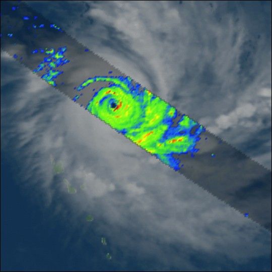
Although the Atlantic and East Pacific hurricane seasons have long drawn to a close, deadly tropical cyclones can still develop around the year in the warm waters of the western Pacific. During the last half of December 2002, Typhoon Zoe developed in the southwestern Pacific and intensified into a rare Category 5 storm with maximum sustained winds exceeding 178 mph with gusts to higher values. This Tropical Rainfall Measurement Mission (TRMM) image collected on December 28 captured the eye of the storm during its peak intensity. The narrow, rapidly rotating eye is surrounded by very intense rains (red colors) produced by thunderclouds towering up to nine miles high. Several small, isolated islands in the Solomons received heavy damage from this storm.
animations
movie(1.3 MB MPEG)
References & Resources
Image courtesy of Jeff Halverson, TRMM Outreach Scientist and Hal Pierce, TRMM Visualizer, both from NASA Goddard Space Flight Center.


