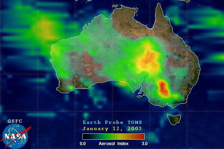
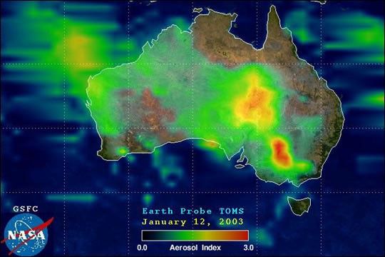
Large fires burning out of control in the Great Dividing Range Mountains in southeast Australia are producing a thick cloud of aerosols over the area. This false-color map of Australia shows an aerosol index produced from data collected by the Total ozone Mapping Spectrometer (TOMS) on January 12, 2003. The index shows how much light was absorbed by aerosols in a column of air between the instrument and the ground. A value of 1 indicates aerosols were reducing the light reaching the ground by about one-thrid, while a value of 3 indicates aerosol so dense that the light was reduced by about 95 percent.
The large cluster of fires in southern New South Wales is easily identified by the large area of red. The aerosol plume clearly affects a larger area than it seems to in true-color imagery. This is because the TOMS aerosol index uses observations collected in the ultraviolet (UV) part of the spectrum. Aerosols that appear transparent in true-color imagery can be revealed by UV analysis. The principle is similar to certain "invisible" magic markers that produce writing that can only be seen under special UV ("black") lights.
References & Resources
Image courtesy Dr. Jay Herman and the TOMS Ocean/UV Research Group, NASA-GSFC