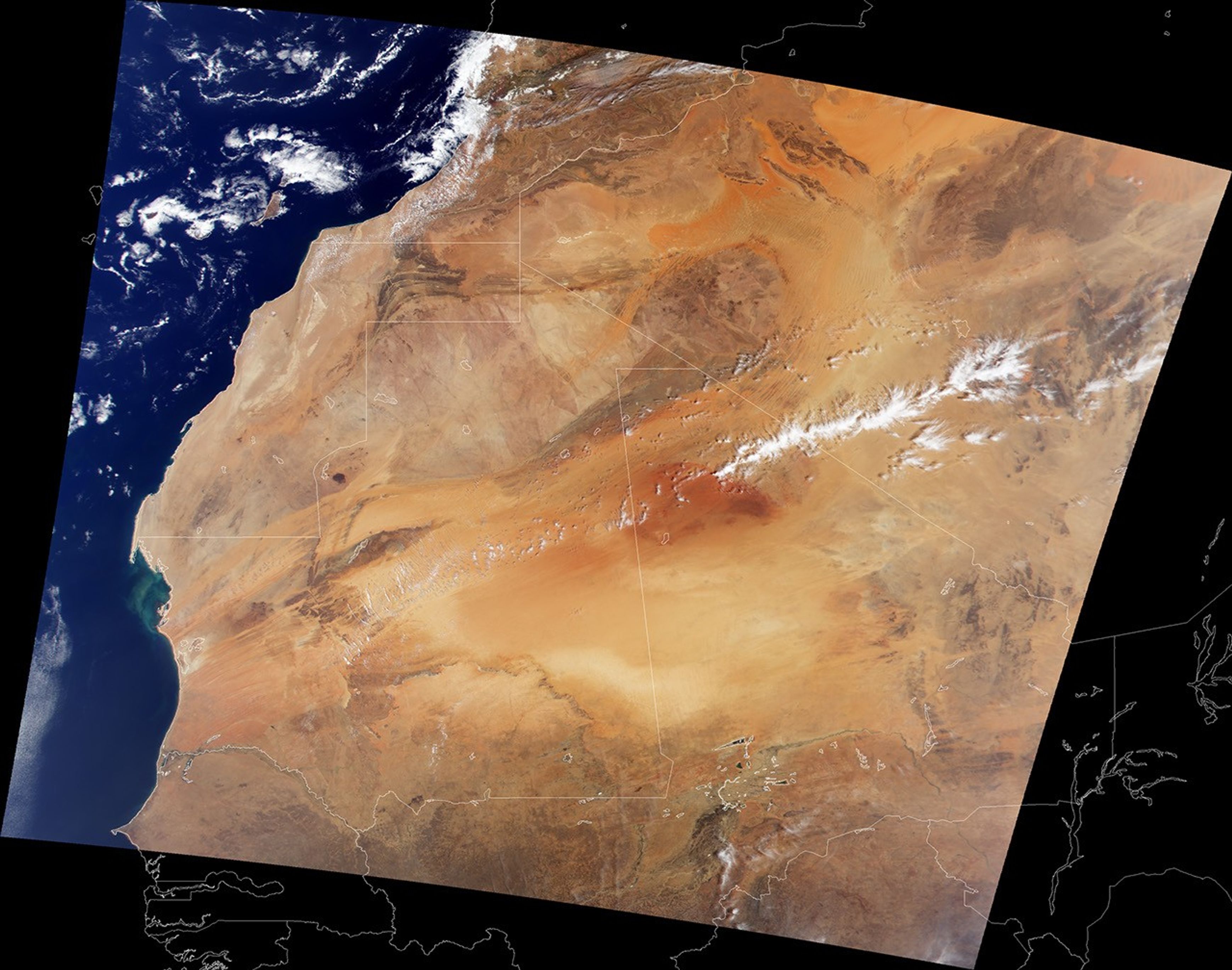


With its vast expanses of sand, framed by mountain ranges and exposedrock, northwestern Africa makes a pretty picture when viewed from above.This image was acquired by the Moderate-resolution ImagingSpectroradiometer (MODIS), flying aboard NASA's Terra spacecraft. TheCanary Islands can be seen on the left side of the image just offAfrica's Atlantic shore. The light brown expanse running through thenorthern two thirds of the image is the Sahara Desert. The desert runsup against the dark brown Haut Atlas mountain range of Morocco in thenorthwest, the Atlantic Ocean to the west and the semi-arid (light brownpixels) Sahelian region in the South.
The Sahara, however, isn't staying put. Since the 1960s, the desert hasbeen expanding into the Sahelian region at a rate of up to 6 kilometersper year. In the 1980s this desert expansion, combined with overcultivation of the Sahel, caused a major famine across west Africa. Overthe summer months, strong winds pick up sands from the Sahara and blowthem across the Atlantic as far west as North America, causing airpollution in Miami and damaging coral reefs in the Bahamas and theFlorida Keys.
The white outlines on the map represent country borders. Starting at thetop-most portion of the map and working clockwise, the countries shownare Morocco, Western Sahara, Mauritania, Senegal, Mali, Burkina Fasso,Nigeria, Mali (again), and Algeria.
References & Resources
Image by Reto Stöckli, Robert Simmon, and Brian Montgomery, NASA Earth Observatory, based on data from MODIS