![Request for Information – Potential [Placeholder for Prize]](https://assets.science.nasa.gov/dynamicimage/assets/science/psd/solar/2023/09/s/solarsystem_0.jpg?w=1024)


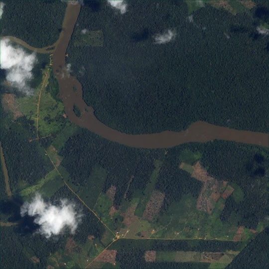
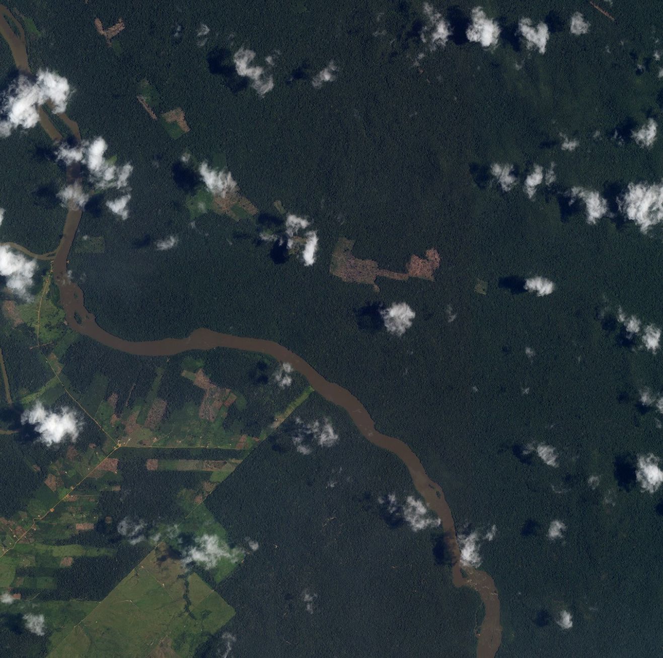
Throughout history, patterns of settlement have followed roads, rivers,and other lines of transportation. The frontiers of the 21st centuryare no exception. This high-resolution image of Amazonia shows farms clearedfrom the jungle spreading out on either side of a narrow dirt road. Above andto the right of the river that bisects the image is almost unbroken forest. Theriver, a tributary of the Amazon, is colored brown by the large amount ofsediment it carries, possibly the result of deforestation upstream.
The image was acquired for the Large Scale Biosphere-AtmosphereExperiment in Amazonia (LBA) by the IKONOS satellite, which is owned andoperated by Space Imaging Corporation. Centered near 10° south, 62° West,the image has a resolution of about 8 meters per pixel, reduced from IKONOS’4-meter maximum color resolution. The LBAis an intensive field campaign in which scientists are studying the environment of Amazonia,the role of Amazonia in global climate, and the effects of human-causedchange in the region.
References & Resources
© All Rights Reserved: Use of IKONOS, GeoEye, QuickBird and WorldView imagery must be coordinated with Maxar.
Image by Robert Simmon, based on IKONOS data provided by DigitalGlobe through the NASA Scientific Data Purchase, with help from Denelle Grant and Compton Tucker, NASA GSFC.© All Rights Reserved: Use of IKONOS, GeoEye, QuickBird, WorldView, and Digital Globe imagery must be coordinated with Maxar.