Suggested Searches

1 min read

Typhoon Etau

Instruments:
2024-08-08 12:00:00
August 8, 2003

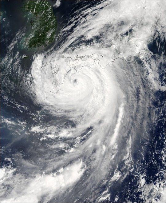
The MODIS instrument on NASA's Aqua spacecraft captured this bird&@8217;s-eye view of Typhoon Etau as it was battering Kyushu, the southernmost of Japan's four main islands, with torrential rains and strong winds. At the time of this image Etau was packing sustained winds of 90 kilometers per hour and was expected to dump as much as 70 cm (27 inches) of rain over the next 24 hours over southern Japan. Etau means "storm cloud" in the language of the Pacific island Palau.

References & Resources

Image courtesy Jeff Schmaltz, MODIS Land Rapid Response Team at NASA GSFC.

You may also be interested in:

Stay up-to-date with the latest content from NASA as we explore the universe and discover more about our home planet.

Ragasa Steers Toward China
3 min read

The super typhoon headed for Guangdong province after lashing Taiwan and northern Luzon in the Philippines.

Article
Winter Grips Japan
3 min read

The country's northern regions are accustomed to snow, but unrelenting storms have snarled transportation and caused other challenges this winter.

Article
Showy Swirls Around Jeju Island
2 min read

Winds blowing past the volcanic landmass near the Korean Peninsula created a trail of spiraling clouds, while murky water churned…

Article