Suggested Searches

1 min read

Dust and Smoke Over West Africa

Instruments:
2004-02-17 00:00:00
February 17, 2004

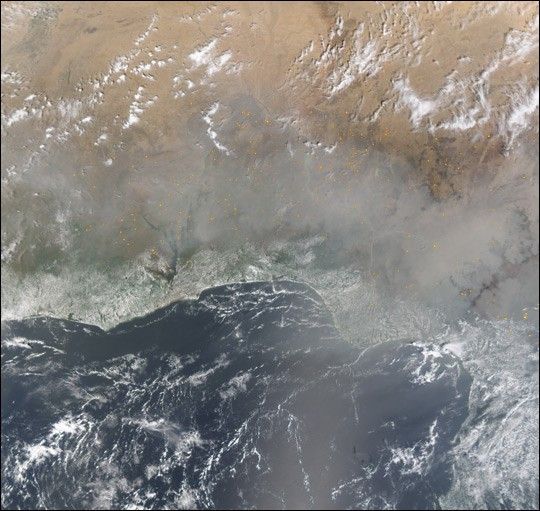
The West African coastline was partially hidden beneath a thick veil of haze—likely a mixture of dust and smoke from numerous agricultural fires—on February 17, 2004. In this Moderate Resolution Imaging Spectroradiometer (MODIS) image from the Terra satellite, the active fire detections made by the sensor are marked in yellow.

References & Resources

Image derived from code developed by the MODIS Rapid Reponse Team using data from the Goddard Earth Sciences DAAC.

You may also be interested in:

Stay up-to-date with the latest content from NASA as we explore the universe and discover more about our home planet.

Smoky Skies in the Pacific Northwest
3 min read

Smoke filled river valleys in northeastern Washington and parts of British Columbia.

Article
Fires on the Rise in the Far North
3 min read

Satellite-based maps show northern wildland fires becoming more frequent and widespread as temperatures rise and lightning reaches higher latitudes.

Article
Fires Erupt in South-Central Chile 
2 min read

Tens of thousands of people fled to safety as blazes spread throughout the country’s Biobío and Ñuble regions.

Article