


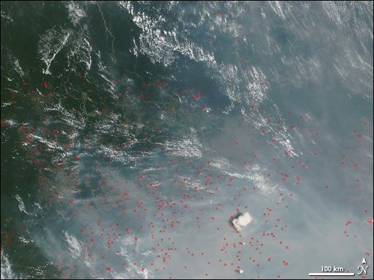
Thick smoke from scores of fires dominates this image of the southern Amazon Rainforest near the Xingu National Park, which is hidden beneath the haze at the right edge of the image. The image was captured by the Moderate Resolution Imaging Spectroradiometer (MODIS) on NASA’s Terra satellite on September 29, 2004. Active fire detections made by MODIS are marked in red. This image illustrates why the southeastern margin of the Amazon is called the “Arc of Deforestation.” At the top of the scene, deep green, intact rainforest is visible, while fires (marked in red) are widespread across the remainer of the scene.
The high-resolution image provided above is 500 meters per pixel. The MODIS Rapid Response System provides this image at additional resolutions.
References & Resources
Image courtesy the MODIS Rapid Response Team, NASA-Goddard Space Flight Center


