





















Suggested Searches

1 min read

Hurricane Alex

Instruments:
Hurricane Alex
August 4, 2004

The MODIS instrument onboard NASA's Terra spacecraft captured this true-color image of Hurricane Alex on August 4, 2004 at 11:00 A.M. EDT. At the time this image was taken Alex was located approximately 400 miles east-northeast of Cape Hatteras, North Carolina and had maximum sustained winds of 85 mph. Alex was moving towards the east-northeast at 20 mph and that motion was expected to continue over the next 24 hours.

The MODIS Rapid Response System provides this image at additional resolutions and formats.

References & Resources

Image courtesy Jacques Descloitres, MODIS Land Rapid Response Team at NASA GSFC.

You may also be interested in:

Stay up-to-date with the latest content from NASA as we explore the universe and discover more about our home planet.

Tropical Storm Arthur
2 min read

The first named storm of the 2026 Atlantic hurricane season brought intense rainfall and the threat of flash flooding to…

Article
Smoke Streams Across Eastern Washington
3 min read

Wildland fires in early August 2026 pushed air quality to unhealthy levels, destroyed hundreds of structures, and triggered mandatory evacuations…

Article
Where Venezuela’s Earthquakes Shifted the Ground
4 min read

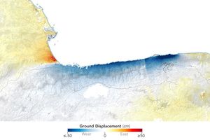
Radar data from the NISAR satellite show that La Guaira and nearby areas experienced significant ground displacement from the June…

Article