





















Suggested Searches

1 min read

Hurricane Charley

Instruments:
2004-08-11 00:00:00
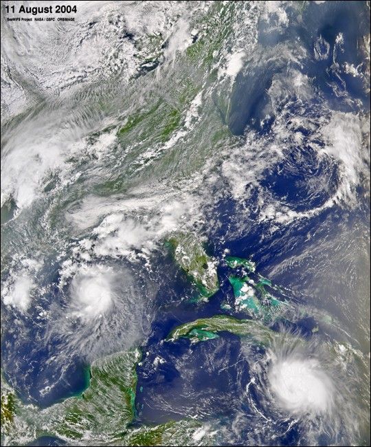
August 11, 2004

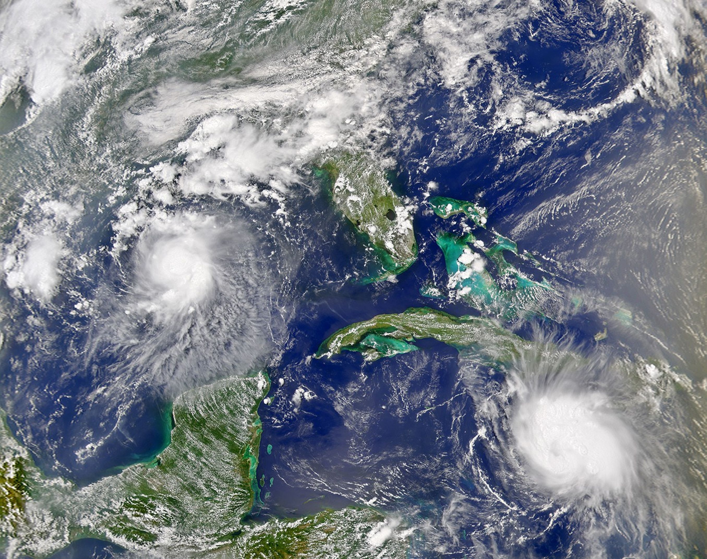
The SeaWiFS instrument onboard the OrbView-2 satellite captured this true-color image of Tropical Storm Bonnie in the Gulf of Mexico and Hurricane Charley in the Caribbean Sea on August 11 at 2:00 PM EDT. At the time this image was taken Bonnie had maximum sustained winds of 65 mph while Charley had just reached hurricane strength with maximum sustained winds of 75 mph. Both storms are expected to impact Florida over the next 48 hours.

References & Resources

Image provided by the SeaWiFS Project, NASA/Goddard Space Flight Center, and ORBIMAGE.
You may also be interested in:

Stay up-to-date with the latest content from NASA as we explore the universe and discover more about our home planet.

Tropical Storm Arthur
2 min read

The first named storm of the 2026 Atlantic hurricane season brought intense rainfall and the threat of flash flooding to…

Article
Lala Batters Hawaii
3 min read

The powerful storm delivered extreme rainfall and damaging winds to the state, passing the Island of Hawaiʻi as a category…

Article
A Trio of Tropical Cyclones in the Pacific
4 min read

The Pacific was buzzing with storms while the Atlantic was notably quiet.

Article