At 5:00 p.m. Atlantic Standard Time (AST) on August 27, 2010, the U.S. National Hurricane Center (NHC) reported that Tropical Storm Earl was 1,140 miles (1,835 kilometers) east of the Northern Leeward Islands, and the government of France had issued a tropical storm watch for French Saint Martin and Saint Barthelemy. The storm had maximum sustained winds of 45 miles (75 kilometers) per hour with higher gusts. The NHC forecast that Earl would continue its westward path, and strengthen to a hurricane by August 29.
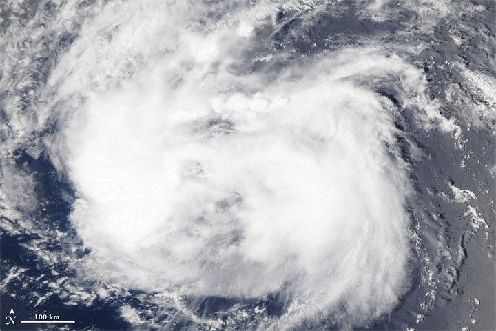
The Moderate Resolution Imaging Spectroradiometer (MODIS) on NASA’s Aqua satellite captured this natural-color image of Tropical Storm Earl over the Atlantic Ocean on August 27, 2010. The storm has neither a distinct eye nor a characteristic spiral shape, but it holds together as a thick cloud mass spanning hundreds of kilometers.
References & Resources
- National Hurricane Center. (2010, August 27). Tropical Storm Earl Advisory Archive. Accessed August 27, 2010.
NASA image courtesy the MODIS Rapid Response Team at NASA GSFC. Caption by Michon Scott.