- High-resolution images:
- Maximum Wave Height (210 kB PDF)
- Travel Time (280 kB PDF)
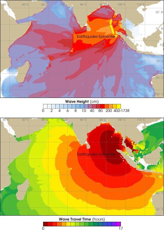
These maps show modeled maximum wave height (top) and travel time (lower) for the Indian Ocean Tsunami of December 26, 2004. Although the epicenter of the earthquake that triggered the tsunami was near the northern tip of Sumatra, the sea floor shifted along an arc stretching about 1200 km to the north. This shifting pushes a mass of water across the Indian Ocean.
The top map shows the maximum wave height that likely occured when the wave came ashore. The coastline of Sumatra, near the fault boundary, received waves over 10 meters tall, while those farther away (Sri Lanka and Thailand) were caught by waves over 4 meters. On the other side of the Indian Ocean, Somalia and the Seychelles were struck by waves approaching 4 meters in height. Travel times (lower) ranged from minutes (Sumatra) to 8 hours (Somalia) or more.
References & Resources
Maps courtesy NOAA Pacific Marine Environmental Laboratory Tsunami Research Program