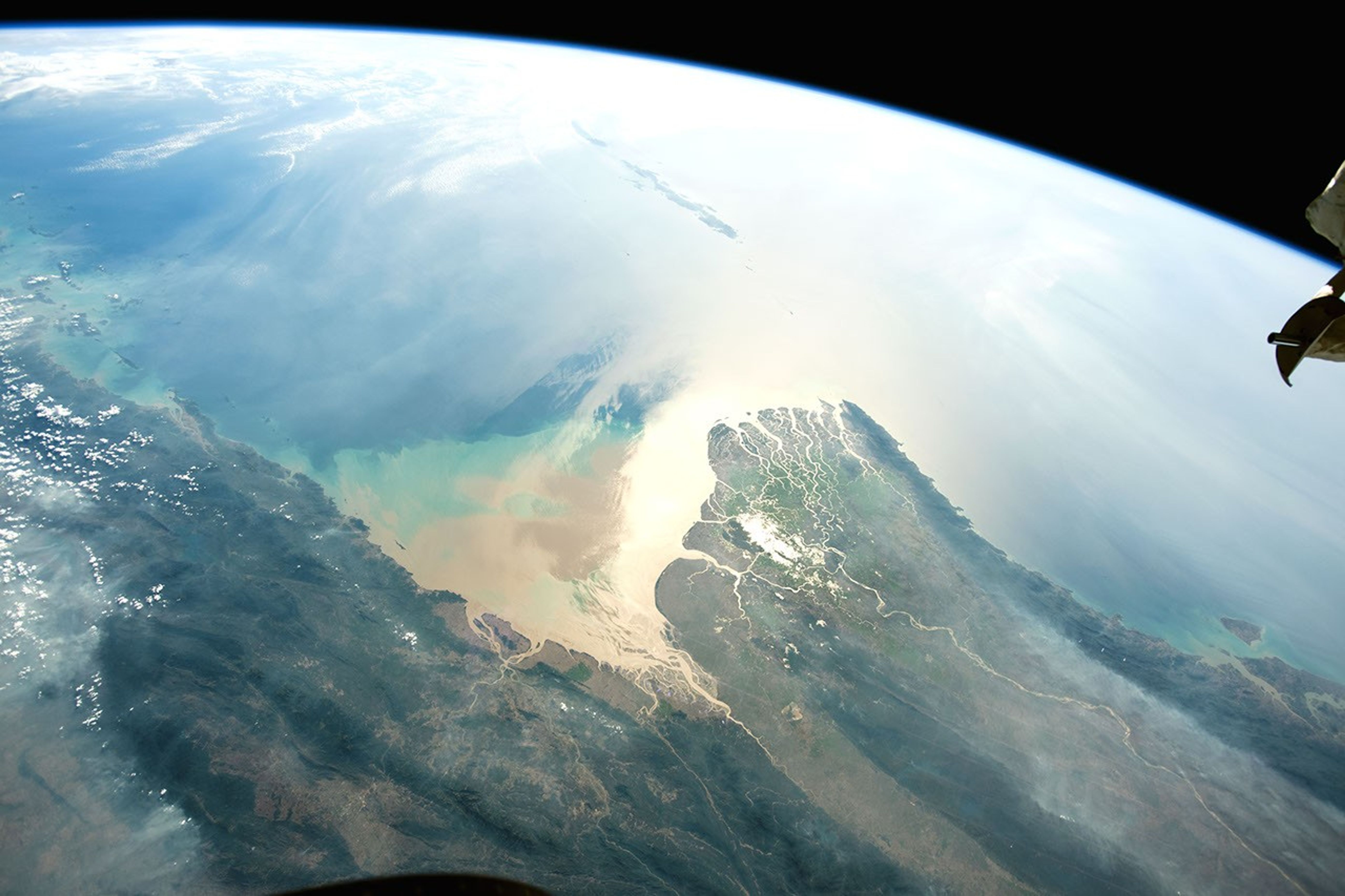
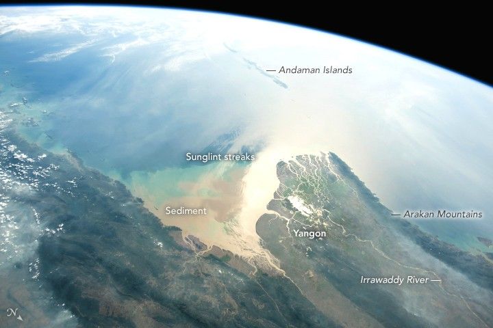
Using a short lens to give a wide view, an astronaut aboard the International Space Station (ISS) focused a camera on the 160 kilometer-wide (100 mile) Irrawaddy river delta. The Irrawaddy is the largest river in Burma (Myanmar) and one of the country’s most important transportation arteries. The former capital city and port of Yangon is situated in a protected location on a major distributary of the Irawaddy.
The very bright zone near the coast is the sunglint point, where sunlight is reflected directly back at the camera. Astronauts frequently use a technique of following the glint point because it strongly emphasizes the details of shorelines.
The Irrawaddy River empties into the Andaman Sea, bringing vast quantities of silt and mud that alter the color of the water near the delta. In this photo, the sediment color pattern is complicated by bright and dark sunglint streaks caused by wind. On this day, westerly winds swept around the southern tip of the Arakan Mountains. (Note that north is to the bottom right of this photo.)
The chain of the Andaman Islands forms a line with the Nicobar Islands (under clouds, top left) along the tectonic margin between the Indian Plate and the Burma Plate. The Andaman Islands experienced a major earthquake of magnitude 9.0 in December 2004.
Related Images
- NASA Earth Observatory (2018, March 19) Lake Darodzan in Sunglint.
- NASA Earth Observatory (2017, January 9) Sunglint on Lake Titicaca.
- NASA Earth Observatory (2016, December 5) Iberá Wetlands in Sunglint.
- NASA Earth Observatory (2014, September 11) The Science of Sunglint.
- NASA Earth Observatory (2006, June 12) Sunglint Features, Lake Erie, United States.
References & Resources
Astronaut photograph ISS058-E-25364 was acquired on February 22, 2019, with a Nikon D5 digital camera using a 24 millimeter lens and is provided by the ISS Crew Earth Observations Facility and the Earth Science and Remote Sensing Unit, Johnson Space Center. The image was taken by a member of the Expedition 58 crew. The image has been cropped and enhanced to improve contrast, and lens artifacts have been removed. The International Space Station Program supports the laboratory as part of the ISS National Lab to help astronauts take pictures of Earth that will be of the greatest value to scientists and the public, and to make those images freely available on the Internet. Additional images taken by astronauts and cosmonauts can be viewed at the NASA/JSC Gateway to Astronaut Photography of Earth. Caption by M. Justin Wilkinson, Texas State University on the Jacobs Contract at NASA-JSC.