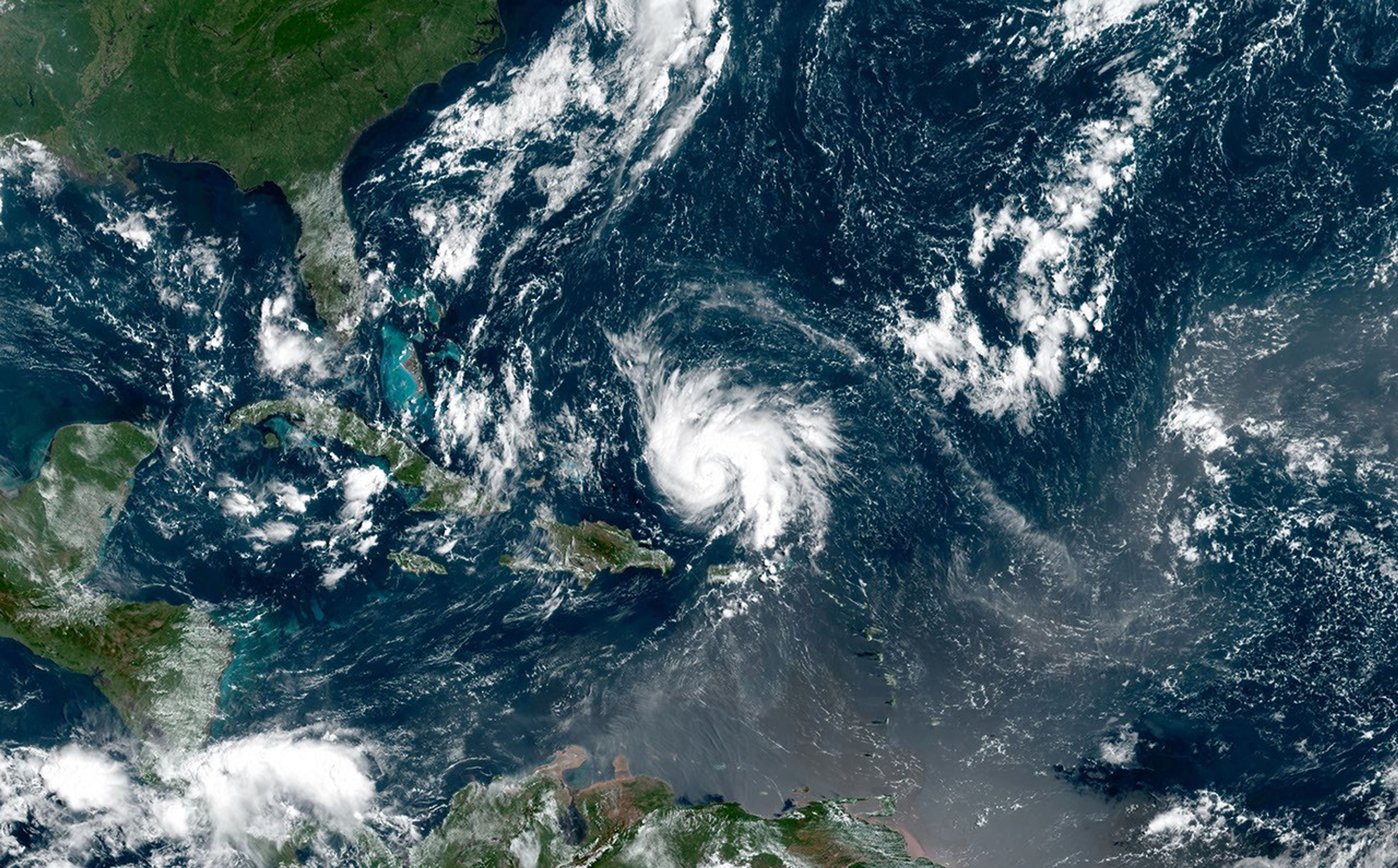
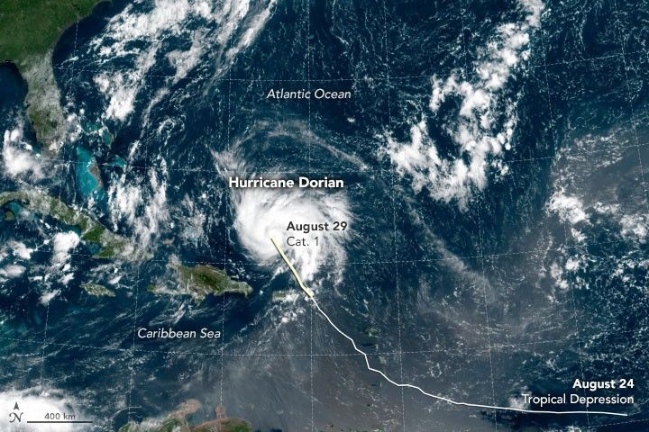
The Geostationary Operational Environmental Satellite 16 (GOES-16) acquired data for this composite image of Hurricane Dorian at 11 a.m. Atlantic Standard Time (15:00 Universal Time) on August 29, 2019. The simulated natural color image comes from the weather satellite’s Advanced Baseline Imager (ABI). GOES-16 is operated by the National Oceanic and Atmospheric Administration (NOAA); NASA helps develop and launch the GOES series of satellites.
As of 10 a.m. AST on August 29, the National Hurricane Center reported sustained winds of 85 miles (140 kilometers) per hour. Forecasters noted: “Strengthening is forecast during the next few days, and Dorian is expected to become a major hurricane on Friday, and remain an extremely dangerous hurricane through the weekend.”
References & Resources
NASA Earth Observatory image by Joshua Stevens, using GOES 16 imagery courtesy of NOAA and the National Environmental Satellite, Data, and Information Service (NESDIS). Caption by Michael Carlowicz.