![Request for Information – Potential [Placeholder for Prize]](https://assets.science.nasa.gov/dynamicimage/assets/science/psd/solar/2023/09/s/solarsystem_0.jpg?w=1024)


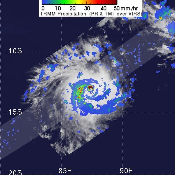
On April 6, 2005, the Tropical Rainfall Measuring Mission satellite flew directly over Cyclone Adeline-Juliet, capturing this image. The image shows a snapshot of the rainfall rates within the storm as seen by the TRMM Precipitation Radar (PR) in the inner swath and TRMM Microwave Imager (TMI) in the outer swath. The rainrates are overlaid on a visible image from the TRMM Visible Infrared Scanner (VIRS). A region of extremely heavy rain, red, circles the eye on the north, and bands of lighter rain swirl characteristically out from the center.
As the image shows, Cyclone Adeline-Juliet is a small, but well-organized storm. With winds gusting up to 260 kilometers per hour (160 mph), the storm is moving west across the Indian Ocean at 17 kph (10 mph). This small, but powerful storm is churning the Indian Ocean, generating waves that reach up to 14 meters or 45 feet high. According to the Joint Typhoon Warning Center, Adeline-Juliet will continue to strengthen over the next two days.
TRMM is a joint mission between NASA and the Japanese space agency JAXA.
References & Resources
NASA image courtesy Hal Pierce, SSAI/NASA GSFC.